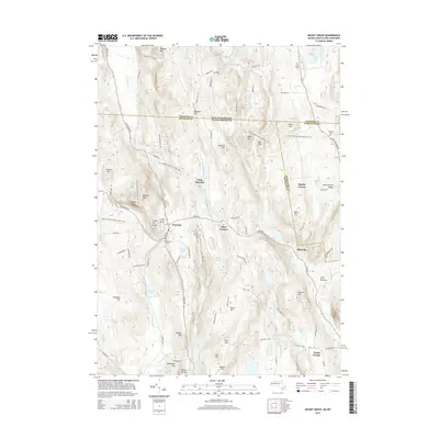
2015 Map of Mount Grace
USGS Topo · Published 2015About this map
Mount Grace and Little Mt Grace dominate the topography of this Franklin County landscape, where the town of Warwick serves as a central hub for the surrounding upland terrain. The map traces the intersection of the New England National Scenic Trail as it winds past Bennetts Knob and Flower Hill, illustrating the area's transition from early industrial water use to modern conservation and recreation. Numerous water bodies like Richards Mill Pond, Sheomet Lake, and Moores Pond are fed by a dense network of brooks including Roaring Brook and Grace Brook, which historically powered local mills. Small historic settlements and named corners, such as Baptist Corners, Blissville, and North Orange, are documented alongside family-named landmarks like Butterworth Ridge and Whipple Hill. Genealogists will find the locations of several burial grounds, including Warwick Cem, Newton Cem, and Perry Cem, essential for tracing family roots in this Massachusetts-New Hampshire border region.
Find a feature on this map
112 named features on this map. Tap any name to fly to it.
Don’t see what you’re looking for? This feature index may not catch every label — zoom into the map to look around manually.
Map Details
Editions of this 2015 Mount Grace Map
This is the sole edition of this map. No revisions or reprints were ever made.
Other maps of this area

1887 · Warwick
USGS Topo · 1:62,500

1887 · Winchendon
USGS Topo · 1:62,500

1889 · Warwick
USGS Topo · 1:62,500

1890 · Winchendon
USGS Topo · 1:62,500

1894 · Winchendon
USGS Topo · 1:62,500

1894 · Warwick
USGS Topo · 1:62,500

1898 · Monadnock
USGS Topo · 1:62,500

1898 · Keene
USGS Topo · 1:62,500

1932 · Warwick
USGS Topo · 1:48,000

1932 · Winchendon
USGS Topo · 1:48,000