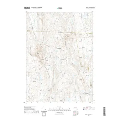
2021 Map of Mount Grace
USGS Topo · Published 2021About this map
Warwick and its surrounding hills occupy the heart of this landscape, situated just south of the New Hampshire Massachusetts state line. The terrain is defined by prominent peaks such as Mt Grace and Tully Mtn, which overlook a network of small settlements and local water bodies. To the east, the area of Baptist Corners and Blissville sits near the headwaters of the Br Tully River, while the southern reaches transition toward North Orange.
Find a feature on this map
121 named features on this map. Tap any name to fly to it.
Don’t see what you’re looking for? This feature index may not catch every label — zoom into the map to look around manually.
Map Details
Editions of this 2021 Mount Grace Map
This is the sole edition of this map. No revisions or reprints were ever made.
Other maps of this area

1887 · Warwick
USGS Topo · 1:62,500

1887 · Winchendon
USGS Topo · 1:62,500

1889 · Warwick
USGS Topo · 1:62,500

1890 · Winchendon
USGS Topo · 1:62,500

1894 · Winchendon
USGS Topo · 1:62,500

1894 · Warwick
USGS Topo · 1:62,500

1898 · Monadnock
USGS Topo · 1:62,500

1898 · Keene
USGS Topo · 1:62,500

1932 · Warwick
USGS Topo · 1:48,000

1932 · Winchendon
USGS Topo · 1:48,000