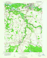
1953 Map of Mount Holly
USGS Topo · Published 1963About this map
Mount Holly serves as the focal point of this mid-century survey, situated at a junction where the North Branch Rancocas Creek winds past the historic County Childrens Home and St Marys Cem. The landscape transitions from the concentrated grid of the county seat into a network of small hamlets and agrarian tracts, such as Lumberton and Vincentown. The presence of Cranberry Bogs near Chairville and the industrial imprint of Kirbys Mill on the Southwest Branch Rancocas Creek highlight the region's long-standing reliance on its water systems for both agriculture and power.
Find a feature on this map
67 named features on this map. Tap any name to fly to it.
Don’t see what you’re looking for? This feature index may not catch every label — zoom into the map to look around manually.
Map Details
Editions of this 1953 Mount Holly Map
2 editions found
Other maps of this area

1888 · Bordentown
USGS Topo · 1:62,500

1888 · Pemberton
USGS Topo · 1:62,500

1888 · Mount Holly
USGS Topo · 1:62,500

1890 · Burlington
USGS Topo · 1:62,500

1893 · Bordentown
USGS Topo · 1:62,500

1893 · Burlington
USGS Topo · 1:62,500

1894 · Pemberton
USGS Topo · 1:62,500

1894 · Mount Holly
USGS Topo · 1:62,500

1898 · Pemberton
USGS Topo · 1:62,500

1898 · Mount Holly
USGS Topo · 1:62,500
Featured Places
- Mount Laurel Township, NJ
- Willingboro Township, NJ
- Medford Township, NJ
- Lumberton Township, NJ
- Mount Holly Township, NJ