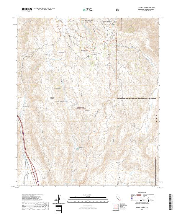
2021 Map of Mount Laguna
USGS Topo · Published 2021About this map
Mount Laguna sits at the heart of this high-elevation landscape, where the Cleveland National Forest meets a complex network of ridges and canyons. The terrain is defined by a series of north-south running valleys including Crouch Valley, Kitchen Valley, and Thunder Valley, separated by prominent heights such as Sheephead Mtn and Stephenson Peak. A sophisticated system of trails, including the Pacific Crest National Scenic Trail and the Desert View Nature Trail, illustrates the area's importance for recreational navigation.
Find a feature on this map
67 named features on this map. Tap any name to fly to it.
Don’t see what you’re looking for? This feature index may not catch every label — zoom into the map to look around manually.
Map Details
Editions of this 2021 Mount Laguna Map
This is the sole edition of this map. No revisions or reprints were ever made.
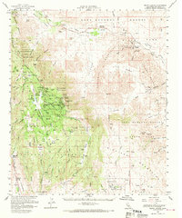
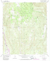
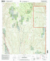
Historical Maps of Mount Laguna Through Time
4 maps found