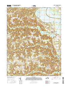
2016 Map of Mount Landing
USGS Topo · Published 2016About this map
Tappahannock serves as a prominent gateway on this Essex County landscape, where the waters of the Rappahannock River meet the intricate network of tidal creeks and swamps. The inland terrain is defined by a series of small, established settlements like Caret, Rexburg, and Dunbrooke, many situated along the historic Tidewater Trl. The map illustrates a rural landscape where the economy and community life were long tied to the drainage patterns of Hoskins Creek and Mount Landing Creek, with numerous smaller hamlets such as Kino and Desha dotting the interior highlands. Genealogists will find particular value in identifying localized landmarks such as Hermon Cem and family-named roads like Warings Mill Rd and Old Courthouse Rd. The presence of features like Scotts Millpond and the various "forks"—including Longist Forks and Henley Fork—points to a history of local commerce and navigation at the headwaters of these coastal tributaries.
Find a feature on this map
94 named features on this map. Tap any name to fly to it.
Don’t see what you’re looking for? This feature index may not catch every label — zoom into the map to look around manually.
Map Details
Editions of this 2016 Mount Landing Map
This is the sole edition of this map. No revisions or reprints were ever made.
Other maps of this area

1889 · Fredericksburg
USGS Topo · 1:125,000

1892 · Fredericksburg
USGS Topo · 1:125,000

1892 · Montross
USGS Topo · 1:62,500

1894 · Fredericksburg
USGS Topo · 1:125,000

1895 · Nomini
USGS Topo · 1:125,000

1895 · Montross
USGS Topo · 1:62,500

1898 · Nomini
USGS Topo · 1:125,000

1918 · Tappahannock
USGS Topo · 1:62,500

1918 · Aylett
USGS Topo · 1:62,500

1919 · Tappahannock
USGS Topo · 1:62,500