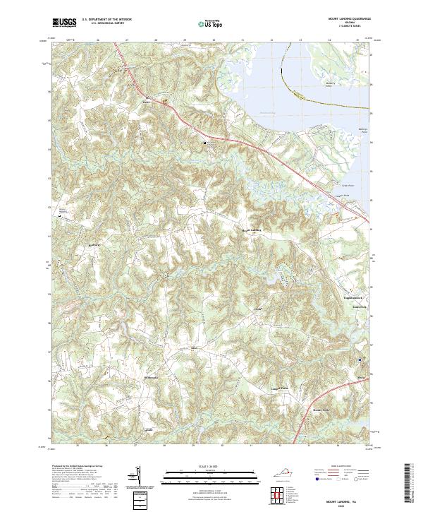
2022 Map of Mount Landing
USGS Topo · Published 2022About this map
The Rappahannock River forms the northeastern boundary of this landscape in Essex County, where the historic shoreline is defined by points like Mulberry Point and Mallorys Point. Inland, the terrain is shaped by a dense network of tidal creeks and swamps, including Mount Landing Creek and the expansive Criddlin Swamp. Small settlements and crossroads such as Mount Landing, Caret, and Rexburg are connected by a web of rural roads, including the prominent Tidewater Trail. Genealogy researchers will find several significant sites for family history, most notably the New Mount Zion Baptist Church Cemetery and the Hermon Methodist Church Cemetery. South of the river, the map details agricultural and forested lands punctuated by small communities like Kino and Desha, leading toward the residential outskirts of Tappahannock.
Find a feature on this map
93 named features on this map. Tap any name to fly to it.
Don’t see what you’re looking for? This feature index may not catch every label — zoom into the map to look around manually.
Map Details
Editions of this 2022 Mount Landing Map
This is the sole edition of this map. No revisions or reprints were ever made.
Other maps of this area

1889 · Fredericksburg
USGS Topo · 1:125,000

1892 · Fredericksburg
USGS Topo · 1:125,000

1892 · Montross
USGS Topo · 1:62,500

1894 · Fredericksburg
USGS Topo · 1:125,000

1895 · Nomini
USGS Topo · 1:125,000

1895 · Montross
USGS Topo · 1:62,500

1898 · Nomini
USGS Topo · 1:125,000

1918 · Tappahannock
USGS Topo · 1:62,500

1918 · Aylett
USGS Topo · 1:62,500

1919 · Tappahannock
USGS Topo · 1:62,500