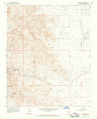
1967 Map of Mount Nutt
USGS Topo · Published 1969About this map
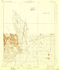
The Black Mountains dominate this 1960s desert landscape, revealing a history of hard-rock mining and travel through the Mohave high country. The iconic Goldroad Mine and Black Eagle Mine stand as primary evidence of the region's mineral industry, accompanied by Tailings and the nearby Goldroad Well. Transportation routes are defined by the geography, including the climb to Sitgreaves Pass and the Tri-State Viewpoint, while a Jeep Trail and Pack Trail suggest more remote access through the canyons. Water, always critical in this environment, is marked at numerous points like Little Meadows, Twin Springs, and Silver Creek. The settlement of Eds Camp sits near the base of the mountains, positioned where the rugged terrain meets the opening of the Sacramento Valley. Notable landmarks like Elephants Tooth and Mount Nutt provide orientation points across this complex of ridges and washes.
Find a feature on this map
46 named features on this map. Tap any name to fly to it.
Don’t see what you’re looking for? This feature index may not catch every label — zoom into the map to look around manually.
Map Details
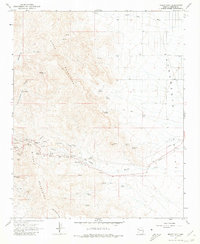
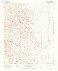
Editions of this 1967 Mount Nutt Map
3 editions found
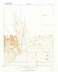
Other maps of this area

1886 · Camp Mohave
USGS Topo · 1:250,000

1892 · Camp Mohave
USGS Topo · 1:250,000

1903 · Needles
USGS Topo · 1:125,000

1904 · Needles Special
USGS Topo · 1:125,000
1927 · Yucca
USGS Topo · 1:62,500
1929 · Yucca
USGS Topo · 1:62,500

1942 · Camp Mohave
USGS Topo · 1:250,000

1947 · Kingman
USGS Topo · 1:250,000

1948 · Kingman
USGS Topo · 1:250,000

1954 · Needles
USGS Topo · 1:250,000