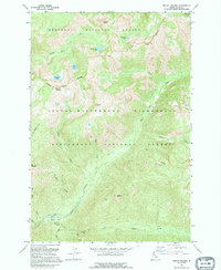
1991 Map of Mount Paloma
USGS Topo · Published 1995About this map
The high ridges of Mount Paloma and Cuneo Point anchor this section of the Idaho backcountry, where the Selway-Bitterroot Wilderness intersects the boundaries of two massive forest reserves. This 1991 imagery-based study details a landscape defined by sharp elevations and alpine basins, containing several high-altitude water bodies including Stingray Lake, Bills Lake, and Emerald Lake. The map reveals a transition of jurisdictional management, with the Nez Perce National Forest meeting the Bitterroot National Forest along a defined interior boundary.
Find a feature on this map
30 named features on this map. Tap any name to fly to it.
Don’t see what you’re looking for? This feature index may not catch every label — zoom into the map to look around manually.
Map Details
Editions of this 1991 Mount Paloma Map
This is the sole edition of this map. No revisions or reprints were ever made.
Other maps of this area

1901 · Hamilton
USGS Topo · 1:125,000

1911 · Lolo
USGS Topo · 1:250,000

1913 · Lolo
USGS Topo · 1:250,000

1956 · Elk City
USGS Topo · 1:250,000

1956 · Hamilton
USGS Topo · 1:250,000

1959 · Hamilton
USGS Topo · 1:250,000

1960 · Elk City
USGS Topo · 1:250,000

1960 · Hamilton
USGS Topo · 1:250,000

1964 · Hamilton
USGS Topo · 1:250,000
1964 · El Capitan
USGS Topo · 1:24,000