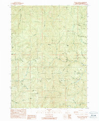
1989 Map of Mount Peavine
USGS Topo · Published 1989About this map
Mount Peavine towers over a landscape defined by its deep mining heritage and rugged drainage networks within the Siskiyou National Forest. During the late 1980s, this area remained a focal point for resource extraction, evidenced by numerous workings such as the Sugar Pine Mine, Victor Mine, and Gold Plate Mine. The terrain is deeply incised by the North Fork Galice Creek and South Fork Galice Creek, with landmarks like Hansen Saddle and Peggler Butte providing vantage points over the complex gulches. Historical occupation is marked by scattered locations like Soldier Camp and Sourgrass Camp, while the presence of a Lookout Tower on the peak of Peavine indicates the ongoing importance of fire observation. The southern portion of the map traces the Silver Creek corridor and the high ground of Cedar Mountain, illustrating the remote and specialized nature of this timber and mineral-producing region.
Find a feature on this map
49 named features on this map. Tap any name to fly to it.
Don’t see what you’re looking for? This feature index may not catch every label — zoom into the map to look around manually.
Map Details
Editions of this 1989 Mount Peavine Map
This is the sole edition of this map. No revisions or reprints were ever made.
Other maps of this area

1917 · Kerby
USGS Topo · 1:125,000

1918 · Kerby
USGS Topo · 1:125,000

1945 · Kerby
USGS Topo · 1:125,000

1946 · Galice
USGS Topo · 1:62,500

1948 · Galice
USGS Topo · 1:62,500

1954 · Marial
USGS Topo · 1:62,500

1954 · Selma
USGS Topo · 1:62,500

1954 · Pearsoll Peak
USGS Topo · 1:62,500

1955 · Medford
USGS Topo · 1:250,000

1957 · Medford
USGS Topo · 1:250,000