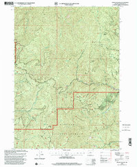
1998 Map of Mount Peavine
USGS Topo · Published 2001About this map
The Siskiyou National Forest dominates this landscape, revealing a history of resource extraction and mountain navigation at the close of the 20th century. High elevations like Mount Peavine and Cedar Mountain are surrounded by a dense network of gulches and creeks, including Silver Creek and Galice Creek. The map provides a detailed look at the region's mining heritage, marking numerous active and historical sites such as Bunker Hill Mine, Victor Mine, and Sugar Pine Mine.
Find a feature on this map
40 named features on this map. Tap any name to fly to it.
Don’t see what you’re looking for? This feature index may not catch every label — zoom into the map to look around manually.
Map Details
Editions of this 1998 Mount Peavine Map
This is the sole edition of this map. No revisions or reprints were ever made.
Other maps of this area

1917 · Kerby
USGS Topo · 1:125,000

1918 · Kerby
USGS Topo · 1:125,000

1945 · Kerby
USGS Topo · 1:125,000

1946 · Galice
USGS Topo · 1:62,500

1948 · Galice
USGS Topo · 1:62,500

1954 · Marial
USGS Topo · 1:62,500

1954 · Selma
USGS Topo · 1:62,500

1954 · Pearsoll Peak
USGS Topo · 1:62,500

1955 · Medford
USGS Topo · 1:250,000

1957 · Medford
USGS Topo · 1:250,000