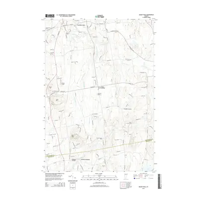
2015 Map of Mount Philo
USGS Topo · Published 2015About this map
Mount Philo dominates the landscape above the rural landscape of the Champlain Valley, marking a terrain of ridges and river valleys south of Burlington. The area is defined by the winding paths of the La Platte River and Lewis Creek, which cut through the agricultural lands of Shelburne Falls, East Charlotte, and North Ferrisburgh. These waterways were once vital to local industry and transport, a legacy preserved in landmarks like the Sequin Covered Bridge and Quinlans Covered Bridge. Local genealogy and settlement history are well-represented by numerous family and community burial grounds, including the Bradley Cem, Burritt Cem, and the Morningside Baptist Church Cem. The map also highlights the intersection of modern and traditional aviation through the presence of Shelburne Airport and Bostwick Farm Airport, while the southern border tracks the boundary between Chittenden Co and Addison Co near Cedar Lake.
Find a feature on this map
64 named features on this map. Tap any name to fly to it.
Don’t see what you’re looking for? This feature index may not catch every label — zoom into the map to look around manually.
Map Details
Editions of this 2015 Mount Philo Map
This is the sole edition of this map. No revisions or reprints were ever made.
Other maps of this area

1894 · Port Henry
USGS Topo · 1:62,500

1895 · Willsboro
USGS Topo · 1:62,500

1898 · Port Henry
USGS Topo · 1:62,500

1903 · Middlebury
USGS Topo · 1:62,500

1905 · Middlebury
USGS Topo · 1:62,500

1906 · Burlington
USGS Topo · 1:62,500

1919 · Burlington
USGS Topo · 1:62,500

1920 · Middlebury
USGS Topo · 1:62,500

1941 · Willsboro
USGS Topo · 1:62,500

1943 · Willsboro
USGS Topo · 1:62,500