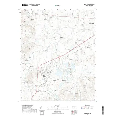
2019 Map of Mount Pleasant
USGS Topo · Published 2019About this map
Mount Pleasant serves as a central hub on this Maury County landscape, where the local economy and history are deeply intertwined with the phosphate industry and rail transport. The map documents industrial legacies such as the Stauffer Chemical Tailings Pond Number Seventeen and the CSX Transportation line that facilitates movement through the valley. Small residential clusters and historic settlements like Frierson Town, Needmore, and Isbell dot the area, often centered around family landmarks and numerous burial grounds. From Saint Johns Cem near Ashwood to the Arlington Cem on the outskirts of the main town, these sites provide significant genealogical value. The terrain is defined by the winding course of Big Bigby Creek and several prominent ridges, including Lusk Ridge and Pisgah Ridge, while the Maury County Airport marks modern infrastructure northwest of Ridley.
Find a feature on this map
150 named features on this map. Tap any name to fly to it.
Don’t see what you’re looking for? This feature index may not catch every label — zoom into the map to look around manually.
Map Details
Editions of this 2019 Mount Pleasant Map
This is the sole edition of this map. No revisions or reprints were ever made.
Other maps of this area

1901 · Colombia
USGS Topo · 1:125,000

1936 · Godwin
USGS Topo · 1:24,000

1936 · Sandy Hook
USGS Topo · 1:24,000

1936 · Williamsport
USGS Topo · 1:24,000

1936 · Mt Joy
USGS Topo · 1:24,000

1936 · Crestview
USGS Topo · 1:24,000

1936 · Greenfield Bend
USGS Topo · 1:24,000

1936 · Mount Pleasant
USGS Topo · 1:24,000

1936 · Columbia
USGS Topo · 1:24,000

1936 · Lynnville
USGS Topo · 1:24,000