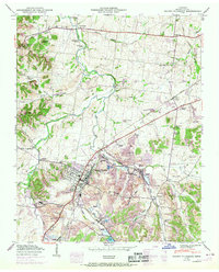
1950 Map of Mount Pleasant
USGS Topo · Published 1969About this map
Industrial and residential life in mid-century Maury County centers on Mount Pleasant, where the Louisville and Nashville railroad serves a landscape heavily shaped by phosphate extraction. Extensive strip mines dominate the terrain east and south of the city, interspersed with industrial infrastructure like the Quality Flume and numerous tailings ponds. This 1950s-era documentation, updated in the late 1960s, reveals a complex social geography through distinct settlements such as Frierson Town, Red Row, and Needmore.
Find a feature on this map
61 named features on this map. Tap any name to fly to it.
Don’t see what you’re looking for? This feature index may not catch every label — zoom into the map to look around manually.
Map Details
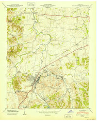
Editions of this 1950 Mount Pleasant Map
2 editions found
Other maps of this area

1901 · Colombia
USGS Topo · 1:125,000

1936 · Godwin
USGS Topo · 1:24,000

1936 · Sandy Hook
USGS Topo · 1:24,000

1936 · Williamsport
USGS Topo · 1:24,000

1936 · Mt Joy
USGS Topo · 1:24,000

1936 · Crestview
USGS Topo · 1:24,000

1936 · Greenfield Bend
USGS Topo · 1:24,000

1936 · Mount Pleasant
USGS Topo · 1:24,000

1936 · Columbia
USGS Topo · 1:24,000

1936 · Lynnville
USGS Topo · 1:24,000