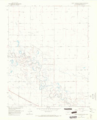
1966 Map of Mount Pleasant School
USGS Topo · Published 1968About this map
Irrigation infrastructure and the meandering Rio Grande define this high-altitude landscape in the San Luis Valley during the mid-1960s. The map captures an intricate network of water management, including the Excelsior Ditch, Centennial Ditch, and Costilla Canal, which support the surrounding agricultural tracts. At the heart of the community stands the Mount Pleasant School, situated along Threemile Road, serving the rural residents of this corner of Alamosa County.
Find a feature on this map
30 named features on this map. Tap any name to fly to it.
Don’t see what you’re looking for? This feature index may not catch every label — zoom into the map to look around manually.
Map Details
Editions of this 1966 Mount Pleasant School Map
This is the sole edition of this map. No revisions or reprints were ever made.
Other maps of this area

1915 · Del Norte
USGS Topo · 1:125,000

1917 · Del Norte
USGS Topo · 1:125,000

1922 · Conejos
USGS Topo · 1:125,000

1945 · Durango
USGS Topo · 1:250,000

1953 · Durango
USGS Topo · 1:250,000

1954 · Durango
USGS Topo · 1:250,000

1954 · Trinidad
USGS Topo · 1:250,000

1955 · Trinidad
USGS Topo · 1:250,000

1958 · Trinidad
USGS Topo · 1:250,000

1959 · Trinidad
USGS Topo · 1:250,000