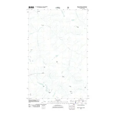
2011 Map of Mount Sefrit
USGS Topo · Published 2011About this map
Mount Sefrit rises at the heart of this high-elevation terrain within the Skagit Range, where complex drainages and narrow ridges define the northern border region. The landscape is marked by the expansive Silesia Creek system, including the West Fork Silesia Creek and Middle Fork Silesia Creek, which carve deep paths through the topography. Evidence of human activity in this wilderness is concentrated around resource extraction and back-country access, notable at the Lone Jack Mine and the remote Silesia Creek Shelter. Travel through the area is dictated by natural corridors like Mamie Pass and Hannegan Pass, with the southern reaches descending toward the Chilliwack River and the dramatic drop of Hells Gorge. The placement of Dead Mans Camp and Hannegan Campground suggests established routes for those navigating the steep elevations between Granite Mountain and Nooksack Ridge.
Find a feature on this map
24 named features on this map. Tap any name to fly to it.
Don’t see what you’re looking for? This feature index may not catch every label — zoom into the map to look around manually.
Map Details
Editions of this 2011 Mount Sefrit Map
This is the sole edition of this map. No revisions or reprints were ever made.
Other maps of this area

1909 · Mt Baker
USGS Topo · 1:192,000

1915 · Mt. Baker
USGS Topo · 1:250,000

1953 · Mt Shuksan
USGS Topo · 1:62,500

1953 · Mt Challenger
USGS Topo · 1:62,500

1955 · Concrete
USGS Topo · 1:250,000

1958 · Concrete
USGS Topo · 1:250,000

1962 · Concrete
USGS Topo · 1:250,000

1979 · Mt. Baker
USGS Topo · 1:100,000
1989 · Shuksan Arm
USGS Topo · 1:24,000
1989 · Copper Mountain
USGS Topo · 1:24,000