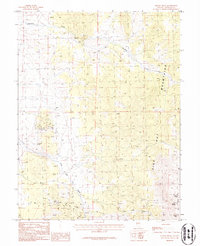
1986 Map of Mount Siegel
USGS Topo · Published 1987About this map
The Pine Nut Mountains dominate this high-desert survey, rising toward the prominent summit of Mount Siegel. This 1980s landscape is defined by its extraction history and difficult access, marked by numerous prospects and established sites like the Monarch Mine and Cherokee Mine. Water management in this arid environment is traced through drainage systems like Buckeye Creek and Pine Nut Creek, while travel is largely limited to 4wd routes that navigate the steep terrain between Galena Saddle and the southern depths of Lone Pine Canyon. The concentration of mining activity on the western slopes suggests a period of intense mineral exploration, leaving a footprint of scattered excavations near Galena Peak.
Find a feature on this map
12 named features on this map. Tap any name to fly to it.
Don’t see what you’re looking for? This feature index may not catch every label — zoom into the map to look around manually.
Map Details
Editions of this 1986 Mount Siegel Map
This is the sole edition of this map. No revisions or reprints were ever made.
Other maps of this area

1889 · Markleeville
USGS Topo · 1:125,000

1891 · Carson
USGS Topo · 1:125,000

1891 · Markleeville
USGS Topo · 1:125,000

1891 · Wabuska
USGS Topo · 1:125,000

1891 · Wellington
USGS Topo · 1:125,000

1893 · Carson
USGS Topo · 1:125,000

1893 · Markleeville
USGS Topo · 1:125,000

1893 · Wellington
USGS Topo · 1:125,000

1894 · Wabuska
USGS Topo · 1:125,000

1948 · Walker Lake
USGS Topo · 1:250,000