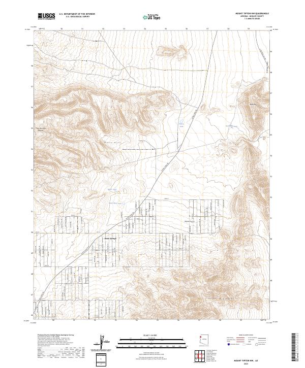
2023 Map of Mount Tipton NW
USGS Topo · Published 2023About this map
Dolan Springs sits at the heart of this high-desert landscape, where a dense grid of residential streets like Orchid Dr and Palo Alto Dr extends into the arid flats. The settlement is anchored by Pierce Ferry Rd, a primary corridor connecting the community to the broader region. The topography is defined by the massive uplift of the Cerbat Mountains in the south and the White Hills to the north, while the Table Mountain Plateau dominates the western horizon.
Find a feature on this map
84 named features on this map. Tap any name to fly to it.
Don’t see what you’re looking for? This feature index may not catch every label — zoom into the map to look around manually.
Map Details
Editions of this 2023 Mount Tipton NW Map
This is the sole edition of this map. No revisions or reprints were ever made.
Other maps of this area

1886 · Camp Mohave
USGS Topo · 1:250,000

1892 · Camp Mohave
USGS Topo · 1:250,000

1942 · Camp Mohave
USGS Topo · 1:250,000

1947 · Kingman
USGS Topo · 1:250,000

1948 · Kingman
USGS Topo · 1:250,000

1954 · Kingman
USGS Topo · 1:250,000

1955 · Kingman
USGS Topo · 1:250,000

1958 · Kingman
USGS Topo · 1:250,000

1960 · Kingman
USGS Topo · 1:250,000
1960 · Senator Mountain
USGS Topo · 1:62,500