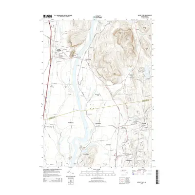
2015 Map of Mount Toby
USGS Topo · Published 2015About this map
The Connecticut River serves as the central artery of this landscape, carving a wide valley between the steep elevations of Mount Toby to the east and Sugarloaf Mtn to the west. This 2015 topography reveals a sophisticated network of river-town settlements like Sunderland and South Deerfield, connected by the historic Sunderland Bridge. To the south, the academic and urban footprint of Amherst is anchored by the Univ of Massachusetts Amherst campus, where Campus Pond sits at the heart of the educational district.
Find a feature on this map
126 named features on this map. Tap any name to fly to it.
Don’t see what you’re looking for? This feature index may not catch every label — zoom into the map to look around manually.
Map Details
Editions of this 2015 Mount Toby Map
This is the sole edition of this map. No revisions or reprints were ever made.
Other maps of this area

1885 · Northampton
USGS Topo · 1:62,500

1886 · Northampton
USGS Topo · 1:62,500

1887 · Warwick
USGS Topo · 1:62,500

1887 · Belchertown
USGS Topo · 1:62,500

1889 · Warwick
USGS Topo · 1:62,500

1890 · Belchertown
USGS Topo · 1:62,500

1890 · Greenfield
USGS Topo · 1:62,500

1891 · Northampton
USGS Topo · 1:62,500

1893 · Northampton
USGS Topo · 1:62,500

1893 · Belchertown
USGS Topo · 1:62,500