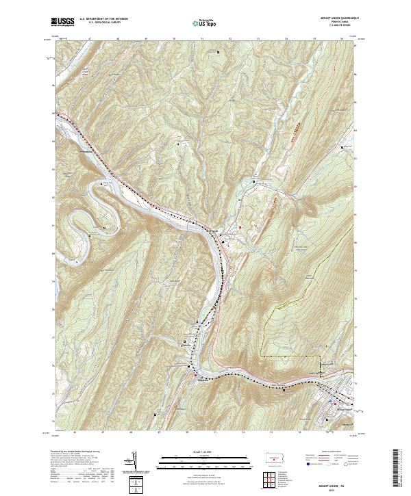
2023 Map of Mount Union
USGS Topo · Published 2023About this map
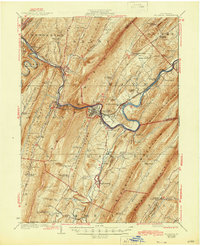
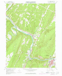
The Juniata River carves a dramatic path through central Pennsylvania, cutting through the gap at Jacks Narrows between Jacks Mountain and Stony Ridge. This area is defined by its deep ridges and narrow valleys, where small settlements like Ardenheim, Mill Creek, and Mapleton established themselves along the water and rail corridors. The presence of Lucy Furnace and various industrial sites near Mount Union points to the region's long-standing reliance on iron production and transportation.
Find a feature on this map
112 named features on this map. Tap any name to fly to it.
Don’t see what you’re looking for? This feature index may not catch every label — zoom into the map to look around manually.
Map Details
Editions of this 2023 Mount Union Map
This is the sole edition of this map. No revisions or reprints were ever made.
Historical Maps of Mount Union Through Time
3 maps found