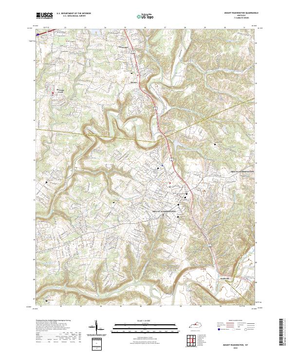
2022 Map of Mount Washington
USGS Topo · Published 2022About this map
Mount Washington serves as the primary hub of this 2022 topographic record, where the convergence of Highway 31 and Highway 150 defines the local transit corridor. The landscape is characterized by a dense network of family-named cemeteries and residential developments situated between Floyds Fork and the Salt River. Historically significant sites for genealogists include Saint Francis Cem, Showalter Cem, and Perkins Cem, which are interspersed among newer estates like Creek View Estates Dr. The northwestern portion of the map features the campus of the Louisville Bible College near Fairmount. Outdoor and community life is anchored by the Jefferson-Sportsmans Club Lake and the Floyd's Fork - Walnut Grove to Cliffside Center Trl, illustrating the area's balance of suburban expansion and conserved riparian corridors.
Find a feature on this map
215 named features on this map. Tap any name to fly to it.
Don’t see what you’re looking for? This feature index may not catch every label — zoom into the map to look around manually.
Map Details
Editions of this 2022 Mount Washington Map
This is the sole edition of this map. No revisions or reprints were ever made.
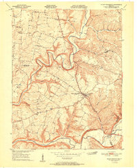
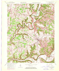
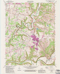
Historical Maps of Mount Washington Through Time
4 maps found