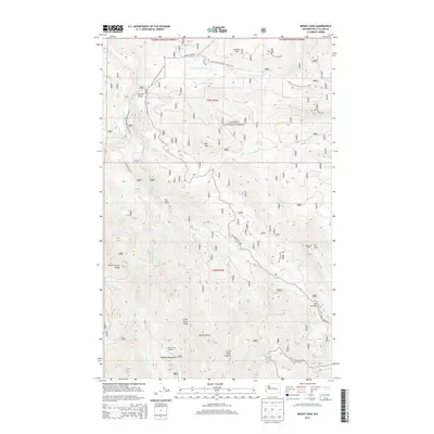
2014 Map of Mount Zion
USGS Topo · Published 2014About this map
Olympic National Forest land dominates this high-elevation survey, centered on the dramatic rise of Mt Zion and its corresponding Mount Zion Lookout. The topography is defined by the steep drainage basins of the Dungeness River and the Little Quilcene River, which carve through the Olympic Mountains landscape. The 2014 data captures a network of specialized infrastructure for forest management and recreation, including the winding Pacific NW National Scenic Trail and established shelters such as the Gold Creek Shelter and Silver Creek Shelter. These locations, alongside named landmarks like Dirty Face Ridge and Sleepy Hollow, trace a modern history of land conservation and backcountry access. The presence of Bon Jon Pass and numerous forest development roads reflects the continued importance of high-country passage for both service and sport in this portion of Clallam County.
Find a feature on this map
37 named features on this map. Tap any name to fly to it.
Don’t see what you’re looking for? This feature index may not catch every label — zoom into the map to look around manually.
Map Details
Editions of this 2014 Mount Zion Map
This is the sole edition of this map. No revisions or reprints were ever made.
Other maps of this area

1938 · Mt Constance
USGS Topo · 1:125,000

1938 · Dungeness
USGS Topo · 1:62,500

1939 · Port Townsend
USGS Topo · 1:62,500

1939 · Dungeness
USGS Topo · 1:62,500

1940 · Quilcene
USGS Topo · 1:62,500

1946 · Tyler Peak
USGS Topo · 1:62,500

1948 · Tyler Peak
USGS Topo · 1:62,500

1953 · Mt. Walker
USGS Topo · 1:24,000
1953 · Uncas
USGS Topo · 1:24,000
1953 · Gardiner
USGS Topo · 1:24,000