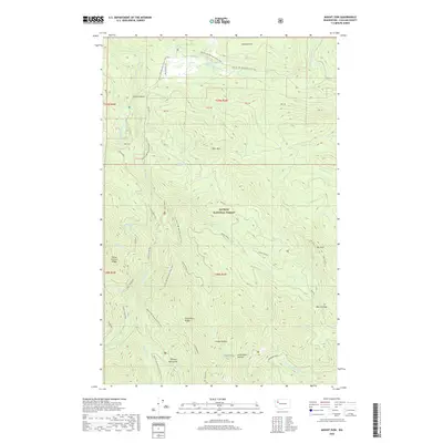
2020 Map of Mount Zion
USGS Topo · Published 2020About this map
Olympic National Forest dominates this section of the northeast Olympic Peninsula, where the landscape is defined by the steep drainages of the Dungeness River and Little Quilcene River. The terrain transitions from the peak of Mt Zion to prominent ridges like Three O'Clock Ridge and Dirty Face Ridge. This 2020 survey illustrates the modern recreation and conservation framework of the region, featuring the extensive route of the Pacific NW National Scenic Trail as it winds through the mountains.
Find a feature on this map
43 named features on this map. Tap any name to fly to it.
Don’t see what you’re looking for? This feature index may not catch every label — zoom into the map to look around manually.
Map Details
Editions of this 2020 Mount Zion Map
This is the sole edition of this map. No revisions or reprints were ever made.
Other maps of this area

1938 · Mt Constance
USGS Topo · 1:125,000

1938 · Dungeness
USGS Topo · 1:62,500

1939 · Port Townsend
USGS Topo · 1:62,500

1939 · Dungeness
USGS Topo · 1:62,500

1940 · Quilcene
USGS Topo · 1:62,500

1946 · Tyler Peak
USGS Topo · 1:62,500

1948 · Tyler Peak
USGS Topo · 1:62,500

1953 · Mt. Walker
USGS Topo · 1:24,000
1953 · Uncas
USGS Topo · 1:24,000
1953 · Gardiner
USGS Topo · 1:24,000