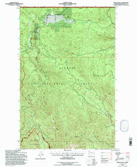
1995 Map of Mount Zion
USGS Topo · Published 1997About this map
The Dungeness River and Gray Wolf River carve through this section of the Olympic Peninsula, defining a landscape dominated by the protected reaches of the Olympic National Forest and the Buckhorn Wilderness. This mid-1990s revision captures a network of high-elevation ridges and deep creek drainages, including the aptly named Dirty Face Ridge and Three O'Clock Ridge. Human footprints in this terrain are primarily found along established trails and forest roads, marked by landmarks like the Gold Creek Shelter and Silver Creek Shelter. The summit of Mount Zion stands as a prominent point in the east, while the Lovella WC settlement provides a rare point of administrative or residential activity near the northern boundary. Numerous quarries dot the hillsides, indicating local extraction efforts amid the heavy timber and drainage systems of Jimmycomelately Creek and Gold Creek.
Find a feature on this map
32 named features on this map. Tap any name to fly to it.
Don’t see what you’re looking for? This feature index may not catch every label — zoom into the map to look around manually.
Map Details
Editions of this 1995 Mount Zion Map
This is the sole edition of this map. No revisions or reprints were ever made.
Other maps of this area

1938 · Mt Constance
USGS Topo · 1:125,000

1938 · Dungeness
USGS Topo · 1:62,500

1939 · Port Townsend
USGS Topo · 1:62,500

1939 · Dungeness
USGS Topo · 1:62,500

1940 · Quilcene
USGS Topo · 1:62,500

1946 · Tyler Peak
USGS Topo · 1:62,500

1948 · Tyler Peak
USGS Topo · 1:62,500

1953 · Mt. Walker
USGS Topo · 1:24,000
1953 · Uncas
USGS Topo · 1:24,000
1953 · Gardiner
USGS Topo · 1:24,000