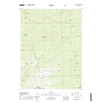
2020 Map of Mountain Dell
USGS Topo · Published 2020About this map
Emigration Canyon and the surrounding high country of the Wasatch National Forest are defined by deep-cut drainages and historic pathways leading toward the valley floor. The map highlights the intersection of modern road networks with storied migration routes, such as the Mormon Trail and the Mormon Pioneer Nht, which cross through Big Mountain Pass. Small enclaves like Pinecrest, Kelvin Grove, and Maple Grove are positioned along the canyon floor, illustrating the localized settlement patterns that follow Emigration Creek. Significant peaks, including Lookout Peak and Bald Mtn, anchor the ridgelines that divide the City Creek Canyon and Red Butte Canyon systems. Farther south, Mountain Dell sits near the confluence of Parleys Creek and Alexander Creek, serving as a central point for both the local geography and the The Sheep Trl that traverses the area.
Find a feature on this map
76 named features on this map. Tap any name to fly to it.
Don’t see what you’re looking for? This feature index may not catch every label — zoom into the map to look around manually.
Map Details
Editions of this 2020 Mountain Dell Map
This is the sole edition of this map. No revisions or reprints were ever made.
Other maps of this area

1885 · Salt Lake
USGS Topo · 1:250,000

1925 · Ft. Douglas
USGS Topo · 1:125,000

1928 · Ft. Douglas
USGS Topo · 1:125,000

1950 · Fort Douglas
USGS Topo · 1:24,000

1951 · Fort Douglas
USGS Topo · 1:24,000

1952 · Sugar House
USGS Topo · 1:24,000

1952 · Bountiful Peak
USGS Topo · 1:24,000

1954 · Salt Lake City
USGS Topo · 1:250,000

1955 · Mount Aire
USGS Topo · 1:24,000

1955 · Park City West
USGS Topo · 1:24,000