Old Maps of Davis County, Utah
Explore 190 old maps of Davis County, spanning from 1885 to today. These high-resolution historic maps reveal how streets, neighborhoods, landmarks, and natural features evolved over time — perfect for genealogy, metal detecting, research, and local history exploration.
What you can do with these maps:
- See how Davis County changed over time: Compare historical maps to modern-day views to trace roads, homesites, rail lines & more.
- View detailed metadata: Each map includes creators, publishers, year, scale, and archive source.
- Overlay maps with satellite & LiDAR: Visualize the past alongside modern tools to explore terrain & human change.
- Trusted historical sources: Maps sourced from the USGS, Library of Congress, and other archives.
- Access maps your way: View online, download high-res files, or order prints for personal or research use.
Start exploring old maps of Davis County to uncover forgotten places, hidden landmarks, and the deep history beneath your feet.
Davis County, UT maps
(190)- 1885 Map of Salt Lake
 1885 Salt Lake1885 Print · USGSThe Wasatch Front and surrounding high valleys appear here in the mid-1880s during a period of rapid mining and rail expansion. Genealogists and historians can trace early town sites and mining camps including Alta, Silver City, and the military grounds of Fort Douglass.7 unique versions available
 - 1885 Map of Tooele Valley
 1885 Tooele Valley1885 Print · USGSThe valleys and ranges west of the Wasatch are captured here in the mid-1880s, showcasing the early mining and rail infrastructure of the region. Genealogists can trace early settlements like Grantsville, Ophir, and Stockton, or the route of the Utah and Nevada R. R.6 unique versions available
 - 1925 Map of Ft. Douglas
 1925 Ft. Douglas1925 Print · USGSThe Wasatch Range in the mid-1920s shows a landscape of mining camps and early mountain tourism. Genealogists and researchers can trace the old paths of the Lincoln Highway and locate vanished stops like Gogorza, Kimballs, and the Pacific Mine.
 - 1928 Map of Ft. Douglas
 1928 Ft. Douglas1928 Print · USGSIn the mid-1920s, the high country east of Salt Lake was a hive of mining and early canyon tourism. Trace old claim sites like the Pacific Mine or visit early retreats such as Pinecrest Inn and the YWCA Camp during the mining era.2 unique versions available
 - 1950 Map of Fort Douglas, 1958 Print
 1950 Fort Douglas1958 Print · USGSThe eastern benches of Salt Lake City meet the Wasatch foothills in the early fifties, showing a city expanding toward the canyons. Genealogists and historians can locate the City Cemetery, the University of Utah, and the This Is the Place Monument.
 - 1951 Map of Fort Douglas
 1951 Fort Douglas1951 Print · USGSSalt Lake City's eastern neighborhoods and the Wasatch foothills are captured in the early fifties, showing the city's growth toward the mountains. Researchers can find precise locations for the University of Utah, the City Cemetery, and the Fort Douglas military grounds.
 - 1951 Map of Saltair, 1952 Print
 1951 Saltair1952 Print · USGSThe eastern shores of the Great Salt Lake are shown in the early 1950s, a time when salt production and private waterfowl clubs dominated the landscape. Genealogists and historians can trace the rail sidings of Riter and Ewing (Siding) or locate landmarks like the K S L Radio Towers and Saltair.2 unique versions available
 - 1951 Map of Salt Lake City North, 1953 Print
 1951 Salt Lake City North1953 Print · USGSSalt Lake City and its northern neighbors appear in the early fifties during a period of significant post-war expansion. Researchers can trace the layout of SALT LAKE CITY and find landmarks like the State Capitol, Becks Hot Springs, and Woods Cross.
 - 1952 Map of Saltair NE, 1953 Print
 1952 Saltair NE1953 Print · USGSThe eastern shores of the Great Salt Lake are documented here during the early fifties, showing a landscape of mineral crusts and early infrastructure. Researchers can trace the path of the Salt Lake City Sewage Canal and the extent of the Salt Flat at a recorded elevation of 4200 feet.2 unique versions available
 - 1952 Map of Farmington, 1954 Print
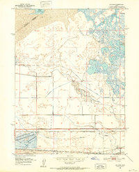
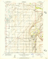
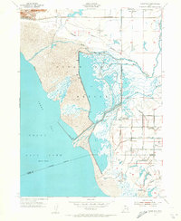
 1952 Farmington1954 Print · USGSDavis County during the early 1950s shows the narrow corridor of growth between the mountains and the Great Salt Lake. Genealogy researchers can trace family homesteads near Woods Cross, find the historic Lagoon grounds, and follow the paths of three major rail lines like the Bamberger Railroad.4 unique versions available
 - 1952 Map of Bountiful Peak, 1954 Print
 1952 Bountiful Peak1954 Print · USGSThe foothills of the Wasatch Range in the early fifties show the expanding street grids of Centerville and Bountiful City. Local historians can trace early civic landmarks like Bountiful High School or follow the narrow Skyline Drive into the mountains.5 unique versions available
 - 1952 Map of Antelope Island South, 1954 Print
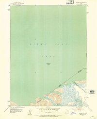
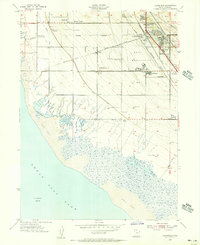
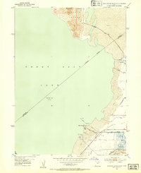 1952 Antelope Island South1954 Print · USGSThe southern shores of the Great Salt Lake are captured here in the early fifties, showcasing a blend of industrial salt works and lakeside recreation. Researchers can trace the layout of the Saltair Resort, locate the historic Roller Coaster, and explore the vast Salt Evaporators along the Garfield and Western Base Line.2 unique versions available
 - 1953 Map of Tooele, 1968 Print
 1953 Tooele1968 Print · USGSTooele County is shown here in the 1950s, a vast landscape transitioning between the industrial growth of the Salt Lake Valley and isolated military testing grounds. Researchers can trace the routes of the Western Pacific railroad and locate historic outposts like Iosepa Ranch and St John Station.3 unique versions available
 - 1954 Map of Antelope Island, 1956 Print
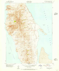 1954 Antelope Island1956 Print · USGSAntelope Island stands as a rugged interior world within the Great Salt Lake during the mid-1950s. Trace old Jeep Trails and paths to remote landmarks like Mollys Nipple, Elephant Head, and the secluded Mushroom Springs.
 - 1954 Map of Antelope Island North, 1956 Print
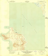 1954 Antelope Island North1956 Print · USGSAntelope Island in the mid-1950s is captured here in its rugged isolation, surrounded by the waters of the Great Salt Lake. Researchers can trace early aviation landmarks like the Antelope Airway Beacon and grazing history at the Tin Lambing Shed Basin.
 - 1954 Map of Salt Lake City, 1964 Print
 1954 Salt Lake City1964 Print · USGSThe Wasatch Front and Uinta Mountains are captured here in the mid-fifties, showing the industrial heart of Utah and its high mountain wilderness. Researchers can locate vanished infrastructure and landmarks like the Geneva Steel Plant, Bingham Canyon Mine, and the Utah State Prison.4 unique versions available
 - 1954 Map of Ogden, 1967 Print
 1954 Ogden1967 Print · USGSThe northern Utah corridor and Wyoming borderlands are captured here in the mid-1950s, showing the region's transition from mountain wilderness to settled valleys. Researchers can trace historic institutions like Utah State University or locate vanished points like Church Butte Station and the Trappist Monastery.3 unique versions available
 - 1954 Map of Brigham City, 1968 Print
 1954 Brigham City1968 Print · USGSNorthern Utah and the edges of the Great Salt Lake are captured here during the mid-fifties, showing the region's transition from pioneer rail hubs to modern military ranges. Researchers can find old sidings like Lemay Siding, the Golden Spike Monument, and settlements like Washakie.4 unique versions available
 - 1955 Map of Ogden, 1956 Print
 1955 Ogden1956 Print · USGSOgden thrived as a rail and military hub in the mid-fifties, squeezed between the river basins and the high peaks of the Wasatch Range. Genealogists and researchers can trace the urban development of South Ogden and Riverdale or locate family sites near the City Cemetery and Sacred Heart Academy.5 unique versions available
 - 1955 Map of Clearfield, 1956 Print
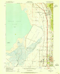
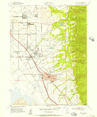
 1955 Clearfield1956 Print · USGSCoastal Davis County is shown in the mid-fifties as the military and rail hub of the region expands toward the Great Salt Lake. Genealogists can trace family plots at West Point Cemetery or locate old school sites like Wasatch Sch and settlements at Laytona.
 - 1955 Map of Roy, 1956 Print
 1955 Roy1956 Print · USGSSettlements along the Weber River valley were rapidly evolving in the mid-fifties as military and rail hubs expanded. Genealogists and historians can trace the foundations of Roy and Clinton, locating family-named landmarks like the Clinton Cemetery and Lakeview School.4 unique versions available
 - 1955 Map of Peterson, 1956 Print
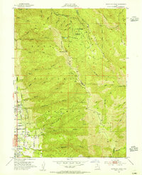
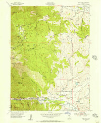
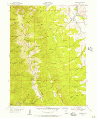 1955 Peterson1956 Print · USGSThe Morgan Valley and Wasatch crest meet in this mid-century survey of the river-and-rail corridor. Trace local landmarks like Peterson Cem and the Union Pacific line, or follow the heights of Francis Peak and Skyline Drive.5 unique versions available
 - 1955 Map of Kaysville, 1956 Print
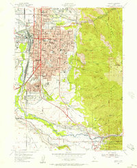
 1955 Kaysville1956 Print · USGSDavis County transitioned from an agrarian valley to a strategic defense hub during the mid-fifties as the suburbs began to expand. You can trace the path of the electric Bamberger Railroad and locate civic landmarks like Sahara Village and the County High School.4 unique versions available
 - 1955 Map of Ogden Bay, 1956 Print
 1955 Ogden Bay1956 Print · USGSThe eastern shores of the Great Salt Lake are captured here in the mid-fifties as water management transformed the Weber River delta. Genealogists and local historians can trace the irrigation networks around Hooper and find sites like Hooper Hot Springs and Hales Bend (Site).
 - 1955 Map of Snow Basin, 1956 Print
 1955 Snow Basin1956 Print · USGSThe Wasatch Range and Weber Canyon are documented here during the mid-1950s, showing early ski infrastructure and mountain industry. Trace local genealogy at the Mtn Green Cemetery or locate the Strawberry Mine and Union Pacific rail line.3 unique versions available
Showing maps 1-25 of 190
Top cities of Davis County
- Layton historical maps
- Bountiful historical maps
- Kaysville historical maps
- Syracuse historical maps
- Clearfield historical maps
- Farmington historical maps
See more
Frequently asked questions
- What are the different types of historical maps available for Davis County?
- What is the oldest map of Davis County?
- Where can I purchase historical maps of Davis County for my home or office?
- Where can I download high-res historical maps of Davis County?
- Are there historical topographic maps available for Davis County?
- Is there historical aerial imagery available for Davis County?
- Where are historical maps of Davis County sourced from?