Old Maps of West Point, Utah
Explore 37 old maps of West Point, spanning from 1954 to today. These high-resolution historic maps reveal how streets, neighborhoods, landmarks, and natural features evolved over time — perfect for genealogy, metal detecting, research, and local history exploration.
What you can do with these maps:
- See how West Point changed over time: Compare historical maps to modern-day views to trace roads, homesites, rail lines & more.
- View detailed metadata: Each map includes creators, publishers, year, scale, and archive source.
- Overlay maps with satellite & LiDAR: Visualize the past alongside modern tools to explore terrain & human change.
- Trusted historical sources: Maps sourced from the USGS, Library of Congress, and other archives.
- Access maps your way: View online, download high-res files, or order prints for personal or research use.
Start exploring old maps of West Point to uncover forgotten places, hidden landmarks, and the deep history beneath your feet.
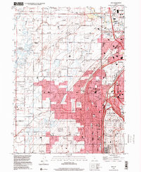
West Point, UT maps
(37)- 1954 Map of Antelope Island North, 1956 Print
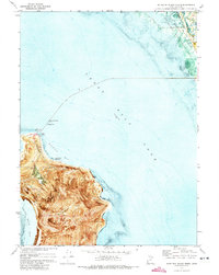
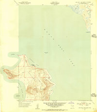 1954 Antelope Island North1956 Print · USGSAntelope Island in the mid-1950s is captured here in its rugged isolation, surrounded by the waters of the Great Salt Lake. Researchers can trace early aviation landmarks like the Antelope Airway Beacon and grazing history at the Tin Lambing Shed Basin.
 - 1954 Map of Brigham City, 1968 Print
 1954 Brigham City1968 Print · USGSNorthern Utah and the edges of the Great Salt Lake are captured here during the mid-fifties, showing the region's transition from pioneer rail hubs to modern military ranges. Researchers can find old sidings like Lemay Siding, the Golden Spike Monument, and settlements like Washakie.4 unique versions available
 - 1955 Map of Clearfield, 1956 Print
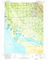
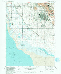
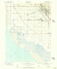 1955 Clearfield1956 Print · USGSCoastal Davis County is shown in the mid-fifties as the military and rail hub of the region expands toward the Great Salt Lake. Genealogists can trace family plots at West Point Cemetery or locate old school sites like Wasatch Sch and settlements at Laytona.
 - 1955 Map of Roy, 1956 Print
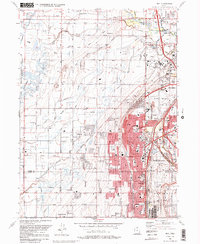
 1955 Roy1956 Print · USGSSettlements along the Weber River valley were rapidly evolving in the mid-fifties as military and rail hubs expanded. Genealogists and historians can trace the foundations of Roy and Clinton, locating family-named landmarks like the Clinton Cemetery and Lakeview School.4 unique versions available
 - 1955 Map of Ogden Bay, 1956 Print
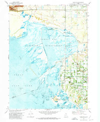
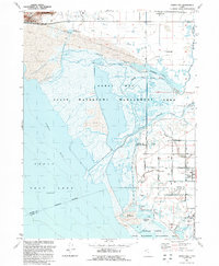
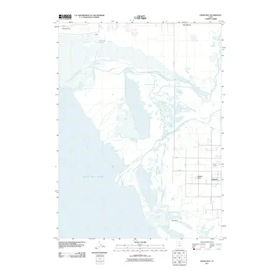
 1955 Ogden Bay1956 Print · USGSThe eastern shores of the Great Salt Lake are captured here in the mid-fifties as water management transformed the Weber River delta. Genealogists and local historians can trace the irrigation networks around Hooper and find sites like Hooper Hot Springs and Hales Bend (Site).
 - 1958 Map of Brigham City
 1958 Brigham City1958 Print · USGSNorthern Utah in the late fifties shows a landscape of extremes, from the salt flats to the bustling Bear River Valley. Trace historical routes like the Old Immigrant Trail and locate local landmarks such as the Brigham Sugar Mill and Booth Valley School.
 - 1962 Map of Brigham City
 1962 Brigham City1962 Print · USGSNorthern Utah in the early sixties reveals a landscape of vast salt flats and growing towns along the Wasatch Front. Researchers can trace the Southern Pacific line past the Golden Spike Monument or locate landmarks like Indian Cave and Donner-Reed Pass.
 - 1972 Map of Antelope Island North, 1973 Print
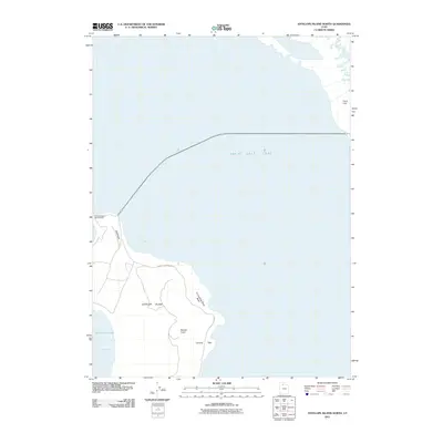
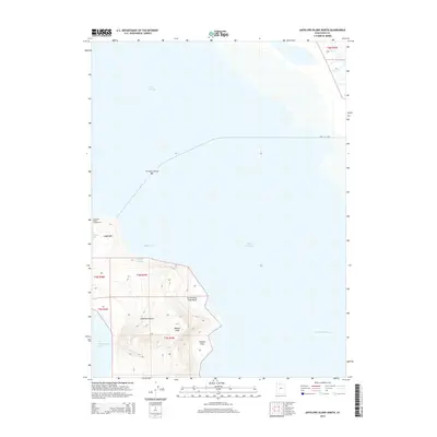
 1972 Antelope Island North1973 Print · USGSAntelope Island and the surrounding waters are documented in the early seventies through this detailed orthophotomap. Genealogists and historians can trace shoreline changes and local landmarks like Ladyfinger Springs, the Great Salt Lake State Park, and Camera Flats.
 - 1972 Map of Clearfield, 1974 Print
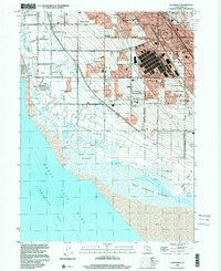
 1972 Clearfield1974 Print · USGSClearfield and Syracuse are shown at a peak of military and industrial activity in the early seventies, between the Great Salt Lake and the mountains. Researchers can trace the layout of Hill Air Force Base, local landmarks like Syracuse Cem, and the massive Freeport Center rail complex.
 - 1972 Map of Ogden Bay, 1974 Print
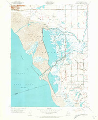
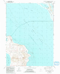
 1972 Ogden Bay1974 Print · USGSThe eastern shore of the Great Salt Lake comes into focus in the early seventies, showing a landscape defined by water management and river deltas. Trace the historic Southern Pacific line past Hooper Hot Springs or locate the Hales Bend site.
 - 1987 Map of Promontory Point
 1987 Promontory Point1987 Print · USGSThe Wasatch Front meets the great salt desert in the late eighties, showing the rapid growth of towns from Brigham City to Layton. Follow the Southern Pacific (Lucin Cutoff) across the water and explore the remote terrain of Antelope Island and Promontory Point.
 - 1990 Map of Roy
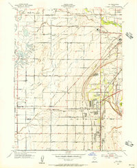
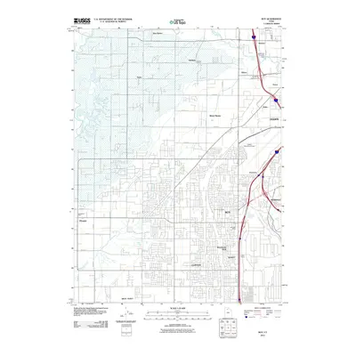
 1990 Roy1990 Print · USGSThe corridor between Ogden and Clinton is shown here in the 1990s, defined by its massive military installations and expanding suburban grid. Researchers can trace local landmarks like Clinton Cem, the Ogden Municipal Airport, and the former Old Railroad Grade.2 unique versions available
 - 1991 Map of Clearfield
 1991 Clearfield1991 Print · USGSDavis County's shoreline meets industrial expansion in the early nineties, showing a landscape defined by water management and military presence. Researchers can trace the sprawling Freeport Center, family roots at West Point Cemetery, and the intricate path of the Hooper Aqueduct.2 unique versions available
 - 1991 Map of Ogden Bay
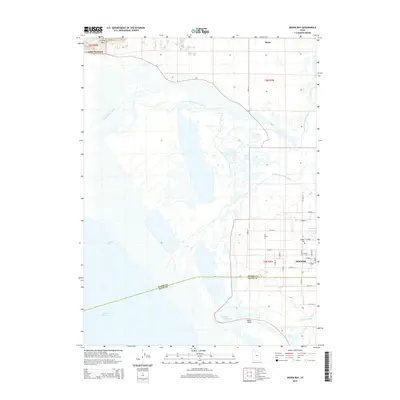
 1991 Ogden Bay1991 Print · USGSThe Weber River delta in the early nineties shows a fascinating mix of managed wetlands and rural Utah settlements. Trace the agricultural layout of Hooper and West Warren, or locate historic sites like Hales Bend and the local Cem.
 - 1991 Map of Antelope Island North
 1991 Antelope Island North1991 Print · USGSThe southeastern Great Salt Lake comes into focus in the early nineties, centered on the northern reaches of Antelope Island. Genealogists and historians can trace the landscape from Bennet to the State Waterfowl Management Area.
 - 1999 Map of Clearfield, 2001 Print
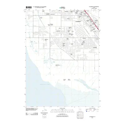
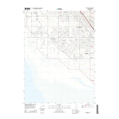
 1999 Clearfield2001 Print · USGSThe eastern shore of the Great Salt Lake comes into focus in the late nineties as residential growth meets major industrial hubs. Researchers can trace the massive Freeport Center, the borders of Hill Air Force Base, and the West Point Cemetery.
 - 1999 Map of Roy, 2001 Print
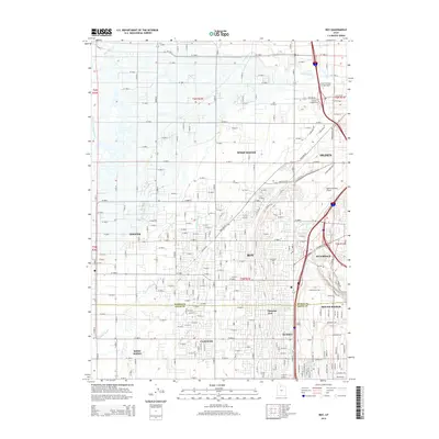
 1999 Roy2001 Print · USGSWeber County's growing suburban and military landscape is captured here during the late 1990s as cities like Roy and Clinton expand. Researchers can trace family history at Stoker Memorial Cemetery or locate landmarks like Hill Air Force Base and the Aerospace Museum.
 - 2011 Map of Antelope Island North, 2011 Print
 2011 Antelope Island North2011 Print · USGSCovers West Point, including Davis County, United States, and other nearby areas
 - 2011 Map of Ogden Bay, 2011 Print
 2011 Ogden Bay2011 Print · USGSCovers West Point, including Hooper, Davis County, and other nearby areas
 - 2011 Map of Clearfield, 2011 Print
 2011 Clearfield2011 Print · USGSCovers West Point, including Layton, Syracuse, and other nearby areas
 - 2011 Map of Roy, 2011 Print
 2011 Roy2011 Print · USGSCovers West Point, including Ogden, Roy, and other nearby areas
 - 2014 Map of Roy, 2014 Print
 2014 Roy2014 Print · USGSCovers West Point, including Ogden, Roy, and other nearby areas
 - 2014 Map of Antelope Island North, 2014 Print
 2014 Antelope Island North2014 Print · USGSCovers West Point, including Davis County, United States, and other nearby areas
 - 2014 Map of Clearfield, 2014 Print
 2014 Clearfield2014 Print · USGSCovers West Point, including Layton, Syracuse, and other nearby areas
 - 2014 Map of Ogden Bay, 2014 Print
 2014 Ogden Bay2014 Print · USGSCovers West Point, including Hooper, Davis County, and other nearby areas
Showing maps 1-25 of 37
Top cities near West Point
- Ogden historical maps
- Layton historical maps
- Bountiful historical maps
- Roy historical maps
- Kaysville historical maps
- Syracuse historical maps
See more
Frequently asked questions
- What are the different types of historical maps available for West Point?
- What is the oldest map of West Point?
- Where can I purchase historical maps of West Point for my home or office?
- Where can I download high-res historical maps of West Point?
- Are there historical topographic maps available for West Point?
- Is there historical aerial imagery available for West Point?
- Where are historical maps of West Point sourced from?