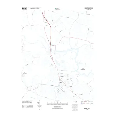
2013 Map of Moyock
USGS Topo · Published 2013About this map
The Northwest River winds through this coastal borderland where North Carolina and Virginia meet, defining a landscape shaped by water and transport. Modern infrastructure like the Chesapeake Expy and Toll Plaza Rd cuts through the region, facilitating travel between Moyock and northern points. Despite this modernization, the area's rural character remains evident in the network of secondary roads such as Ballahack Rd and Indian Creek Rd, which connect older settlement points like Saint Brides and Northwest.
Find a feature on this map
84 named features on this map. Tap any name to fly to it.
Don’t see what you’re looking for? This feature index may not catch every label — zoom into the map to look around manually.
Map Details
Editions of this 2013 Moyock Map
This is the sole edition of this map. No revisions or reprints were ever made.
Other maps of this area

1939 · Moyock
USGS Topo · 1:62,500

1940 · Lake Drummond
USGS Topo · 1:62,500

1940 · South Mills
USGS Topo · 1:62,500

1945 · Lake Drummond
USGS Topo · 1:62,500

1946 · Moyock
USGS Topo · 1:62,500

1948 · Elizabeth City
USGS Topo · 1:62,500

1952 · South Mills
USGS Topo · 1:62,500

1953 · Norfolk
USGS Topo · 1:250,000
1954 · Fentress
USGS Topo · 1:24,000
1954 · Pleasant Ridge
USGS Topo · 1:24,000