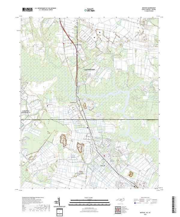
2022 Map of Moyock
USGS Topo · Published 2022About this map
The Virginia-North Carolina border line bisects this coastal plain landscape, where the Northwest River and its tributaries define the regional layout. This recent survey highlights the persistent rural character of Currituck County and the city of Chesapeake, with hydrology playing a central role in land use. The presence of Light Swamp and waterways like Shingle Landing Creek and Indian Creek suggests a terrain shaped by drainage and low-lying wetlands.
Find a feature on this map
92 named features on this map. Tap any name to fly to it.
Don’t see what you’re looking for? This feature index may not catch every label — zoom into the map to look around manually.
Map Details
Editions of this 2022 Moyock Map
This is the sole edition of this map. No revisions or reprints were ever made.
Other maps of this area

1939 · Moyock
USGS Topo · 1:62,500

1940 · Lake Drummond
USGS Topo · 1:62,500

1940 · South Mills
USGS Topo · 1:62,500

1945 · Lake Drummond
USGS Topo · 1:62,500

1946 · Moyock
USGS Topo · 1:62,500

1948 · Elizabeth City
USGS Topo · 1:62,500

1952 · South Mills
USGS Topo · 1:62,500

1953 · Norfolk
USGS Topo · 1:250,000
1954 · Fentress
USGS Topo · 1:24,000
1954 · Pleasant Ridge
USGS Topo · 1:24,000