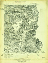
1909 Map of Mt. Baker
USGS Topo · Published 1915About this map
The Mt Baker massif and the northern reaches of the Washington National Forest define this terrain, which was surveyed shortly after the turn of the century by the United States and Canada Boundary Commission. At this time, the upper Nooksack River valley was a hub of early industrial activity, anchored by the Excelsior Power Plant and the remote Lone Jack Mine near the international border. The southern portion of the sheet reveals the early development of the Skagit River corridor, where the Great Northern Railway serves a string of river settlements including Hamilton, Birdsview, and Concrete. This map captures a landscape in transition, where family-named landmarks like Morovits Ranch and Thompsons Ranch stood alongside massive natural features like the Coleman Glacier and Mazama Glacier, providing a detailed look at the region's early logging and mining infrastructure.
Find a feature on this map
66 named features on this map. Tap any name to fly to it.
Don’t see what you’re looking for? This feature index may not catch every label — zoom into the map to look around manually.
Map Details
Editions of this 1909 Mt. Baker Map
3 editions found
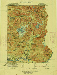
Other maps of this area

1899 · Glacier Peak
USGS Topo · 1:125,000

1899 · Stillaguamish
USGS Topo · 1:125,000

1901 · Glacier Peak
USGS Topo · 1:125,000

1901 · Stilaguamish
USGS Topo · 1:125,000

1909 · Mt Baker
USGS Topo · 1:192,000

1911 · Mount Vernon
USGS Topo · 1:125,000

1915 · Mt. Baker
USGS Topo · 1:250,000

1919 · Van Zandt
USGS Topo · 1:62,500

1921 · Wickersham
USGS Topo · 1:62,500

1944 · Clear Lake
USGS Topo · 1:62,500