
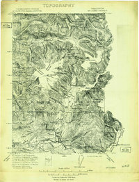
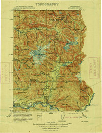
1909 Map of Mt Baker
USGS Topo · Published 1909About this map
MT Baker and the surrounding heights of the Washington National Forest dominate this northern Washington landscape during a period of early industrial development. The survey, conducted by J.E. Blackburn and Robert Muldrow, documents the critical early infrastructure of the North Cascades, including the Excelsior Power Plant and another Power Plant further south along the Baker River. In the Skagit Valley, the economy is driven by rail and river, with the Great Northern and the Puget Sound and Baker River railroads connecting timber and mineral resources to emerging settlements like Concrete and Hamilton. The map provides a detailed view of the high-country terrain, marking summits such as Mt Shuksan and Yellow Aster Butte, while tracing the remote paths to Morovits Ranch and the early outpost at Glacier near the Canadian border.
Find a feature on this map
41 named features on this map. Tap any name to fly to it.
Don’t see what you’re looking for? This feature index may not catch every label — zoom into the map to look around manually.
Map Details
Editions of this 1909 Mt Baker Map
3 editions found
Other maps of this area

1899 · Glacier Peak
USGS Topo · 1:125,000

1899 · Stillaguamish
USGS Topo · 1:125,000

1901 · Glacier Peak
USGS Topo · 1:125,000

1901 · Stilaguamish
USGS Topo · 1:125,000

1911 · Mount Vernon
USGS Topo · 1:125,000

1915 · Mt. Baker
USGS Topo · 1:250,000

1919 · Van Zandt
USGS Topo · 1:62,500

1921 · Wickersham
USGS Topo · 1:62,500

1944 · Clear Lake
USGS Topo · 1:62,500

1951 · Wickersham
USGS Topo · 1:62,500