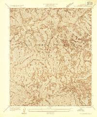
1935 Map of Mt. Gleason
USGS Topo · Published 1935About this map
Mt Gleason stands as the literal and figurative high point of this 1935 survey, which details a highly vertical landscape within the Angeles National Forest. The map, an advance sheet prepared by the Board of Supervisors of Los Angeles County, reveals a terrain defined by deep drainages like Mill Creek Canyon and the winding course of the North Fork Tujunga Creek. Human presence is sparse, limited to remote sites such as Colby Ranch and Messenger Flats.
Find a feature on this map
15 named features on this map. Tap any name to fly to it.
Don’t see what you’re looking for? This feature index may not catch every label — zoom into the map to look around manually.
Map Details
Editions of this 1935 Mt. Gleason Map
This is the sole edition of this map. No revisions or reprints were ever made.
Other maps of this area

1900 · Tujunga
USGS Topo · 1:62,500

1901 · Southern California Sheet No. 1
USGS Topo · 1:250,000

1904 · Southern California Sheet No. 1
USGS Topo · 1:250,000
1928 · La Crescenta
USGS Topo · 1:24,000

1930 · Ravenna
USGS Topo · 1:24,000
1933 · La Crescenta
USGS Topo · 1:24,000
1934 · Mt. Lowe
USGS Topo · 1:24,000
1934 · Ravenna
USGS Topo · 1:24,000
1934 · Mt. Wilson
USGS Topo · 1:24,000
1934 · Acton
USGS Topo · 1:24,000