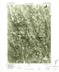
1975 Map of Mt Grace
USGS Topo · Published 1981About this map
The town of Warwick serves as the focal point of this 1975 orthophotoquad, which uses rectified aerial imagery to document the wooded landscape of Franklin County. Unlike traditional topographic maps, this imagery-based study provides a literal view of the dense forest canopy and clearing patterns around Mayo Corners and the northern reaches of North Orange. The terrain is defined by significant elevations, including the prominent peak of Mt Grace and the surrounding heights of Mayo Hill and Temple Hill.
Find a feature on this map
8 named features on this map. Tap any name to fly to it.
Don’t see what you’re looking for? This feature index may not catch every label — zoom into the map to look around manually.
Map Details
Editions of this 1975 Mt Grace Map
This is the sole edition of this map. No revisions or reprints were ever made.
Other maps of this area

1887 · Warwick
USGS Topo · 1:62,500

1887 · Winchendon
USGS Topo · 1:62,500

1889 · Warwick
USGS Topo · 1:62,500

1890 · Winchendon
USGS Topo · 1:62,500

1894 · Winchendon
USGS Topo · 1:62,500

1894 · Warwick
USGS Topo · 1:62,500

1898 · Monadnock
USGS Topo · 1:62,500

1898 · Keene
USGS Topo · 1:62,500

1932 · Warwick
USGS Topo · 1:48,000

1932 · Winchendon
USGS Topo · 1:48,000