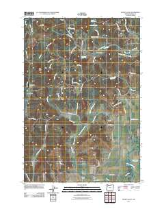
2011 Map of Muddy Valley
USGS Topo · Published 2011About this map
Muddy Creek and its many branches, including the Middle Fork Muddy Creek and East Fork Muddy Creek, dominate this rural landscape southwest of McMinnville. The map illustrates a complex network of narrow valleys and ridges, where small communities like Happy Valley and Gopher Valley developed around these watercourses. Agriculture and rural life are centered on the lower elevations, marked by features such as the Happy Valley Cemetery and South Yamhill Cemetery.
Find a feature on this map
67 named features on this map. Tap any name to fly to it.
Don’t see what you’re looking for? This feature index may not catch every label — zoom into the map to look around manually.
Map Details
Editions of this 2011 Muddy Valley Map
This is the sole edition of this map. No revisions or reprints were ever made.
Other maps of this area

1924 · Mc Minnville
USGS Topo · 1:48,000

1926 · Mc Minnville
USGS Topo · 1:62,500

1940 · McMinnville
USGS Topo · 1:62,500

1941 · Yamhill
USGS Topo · 1:62,500

1942 · Sheridan
USGS Topo · 1:62,500

1942 · Yamhill
USGS Topo · 1:62,500

1942 · Fairdale
USGS Topo · 1:62,500

1948 · Vancouver
USGS Topo · 1:250,000

1950 · Vancouver
USGS Topo · 1:250,000

1950 · Vancouver
USGS Topo · 1:250,000