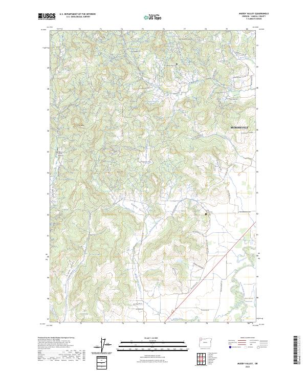
2023 Map of Muddy Valley
USGS Topo · Published 2023About this map
Happy Valley and the western fringes of Mcminnville anchor this survey of the northern Willamette Valley foothills. The landscape is defined by the drainage systems of Baker Creek and Muddy Creek, which cut through a terrain of named rises including Slide Mtn and The Butte. Agricultural activity is evident in the presence of Yamhill Orchards and numerous small-scale water management features like Mochettaz Reservoir and Sander Reservoir. Genealogists and local historians will find value in the placement of the Happy Valley Cem and South Yamhill Cem. The map also captures the local transportation and utility infrastructure, from the small Deer Creek Airport to the network of winding roads like NW High Heaven Rd and Gopher Valley Rd that navigate the varied elevations of Muddy Valley and Dupee Valley.
Find a feature on this map
76 named features on this map. Tap any name to fly to it.
Don’t see what you’re looking for? This feature index may not catch every label — zoom into the map to look around manually.
Map Details
Editions of this 2023 Muddy Valley Map
This is the sole edition of this map. No revisions or reprints were ever made.
Other maps of this area

1924 · Mc Minnville
USGS Topo · 1:48,000

1926 · Mc Minnville
USGS Topo · 1:62,500

1940 · McMinnville
USGS Topo · 1:62,500

1941 · Yamhill
USGS Topo · 1:62,500

1942 · Sheridan
USGS Topo · 1:62,500

1942 · Yamhill
USGS Topo · 1:62,500

1942 · Fairdale
USGS Topo · 1:62,500

1948 · Vancouver
USGS Topo · 1:250,000

1950 · Vancouver
USGS Topo · 1:250,000

1950 · Vancouver
USGS Topo · 1:250,000