Loading...
Loading map...2024 Map of Munford
USGS Topo · Published 2024About this map
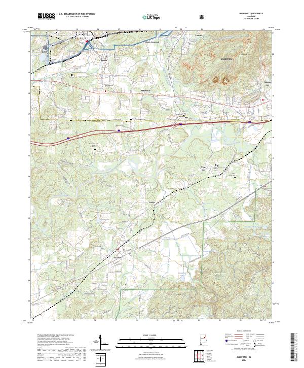
The Talladega National Forest dominates the southern landscape of this 2024 map, where the foothills meet industrial and military sites. The north is defined by the Anniston Army Depot and the sprawling residential networks of Anniston and Oxford. Between these urban centers and the timbered slopes of Kentuck Mountain lie smaller communities like Munford and Jenifer, which retain a rural character.
Find a feature on this map
136 named features on this map. Tap any name to fly to it.
Don’t see what you’re looking for? This feature index may not catch every label — zoom into the map to look around manually.
Map Details
Date Portrayed2024
Date Published2024
PublisherU.S. Geological Survey
Map TypeTopographic
Scale1:24000
Physical Dimensions24 x 29 inches
Editions of this 2024 Munford Map
This is the sole edition of this map. No revisions or reprints were ever made.
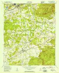
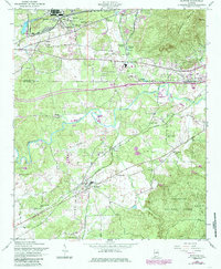
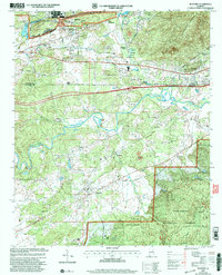
Historical Maps of De Soto Manor Through Time
4 maps found
Featured Locations
Source Details
SourceU.S. Geological Survey
CopyrightPublic Domain