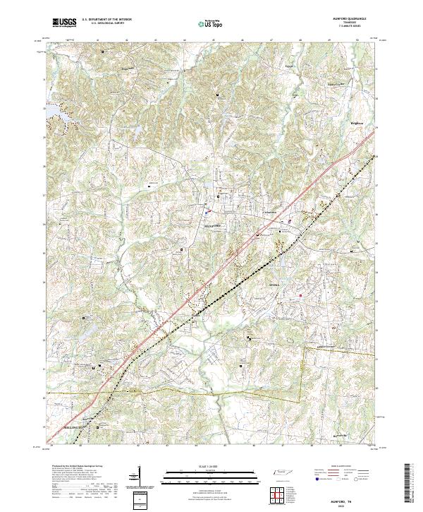
2022 Map of Munford
USGS Topo · Published 2022About this map
Munford and Atoka serve as the primary population centers along this corridor in West Tennessee, where the residential landscape is deeply intertwined with local family history and rural traditions. The map is particularly notable for its dense concentration of family burial grounds and church-affiliated cemeteries, such as the Wooten Family Cem, Old Craig Graveyard, and Union Hill Baptist Church Cem. These sites, alongside larger landmarks like the Upper Canaan Baptist Church Memorial Gardens, reflect the deep roots of the communities established north of the Shelby Co line.
Find a feature on this map
210 named features on this map. Tap any name to fly to it.
Don’t see what you’re looking for? This feature index may not catch every label — zoom into the map to look around manually.
Map Details
Editions of this 2022 Munford Map
This is the sole edition of this map. No revisions or reprints were ever made.