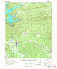
1972 Map of Murfreesboro
USGS Topo · Published 1973About this map
Lake Greeson dominates the northern landscape of this Pike County survey, created by the impoundment of the Little Missouri River at Narrows Dam. The map documents a fascinating intersection of geological wonder and cultural history, most notably the Crater of Diamonds (Diamond Mine) located south of Murfreesboro. This area is the only site in North America where diamonds have been mined from their volcanic source, a point of significant interest for both geologists and local historians.
Find a feature on this map
98 named features on this map. Tap any name to fly to it.
Don’t see what you’re looking for? This feature index may not catch every label — zoom into the map to look around manually.
Map Details
Editions of this 1972 Murfreesboro Map
This is the sole edition of this map. No revisions or reprints were ever made.
Other maps of this area

1901 · Gurdon
USGS Topo · 1:125,000

1906 · Caddo Gap
USGS Topo · 1:125,000

1936 · Athens
USGS Topo · 1:48,000

1936 · Glenwood
USGS Topo · 1:48,000

1942 · Glenwood
USGS Topo · 1:62,500

1942 · Athens
USGS Topo · 1:62,500

1943 · Antoine
USGS Topo · 1:62,500

1949 · Glenwood
USGS Topo · 1:62,500

1951 · Nashville
USGS Topo · 1:24,000

1951 · Pisgah
USGS Topo · 1:24,000