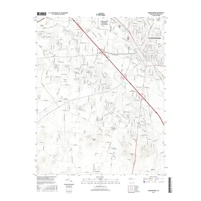
2016 Map of Murfreesboro
USGS Topo · Published 2016About this map
Stones River National Battlefield occupies the northwest corridor of this 2016 survey, preserving the grounds where one of the Civil War's bloodiest conflicts unfolded. The landscape transitions from the urban density of Murfreesboro in the east to the outlying rural settlements of Salem, Overall, and Barfield in the southwest. A remarkable density of family and community burial grounds, including Evergreen Cem, Old City Cem, and Yeargan Cem, highlights the long-standing genealogical roots of Rutherford County.
Find a feature on this map
68 named features on this map. Tap any name to fly to it.
Don’t see what you’re looking for? This feature index may not catch every label — zoom into the map to look around manually.
Map Details
Editions of this 2016 Murfreesboro Map
This is the sole edition of this map. No revisions or reprints were ever made.
Other maps of this area

1916 · Murfreesboro
USGS Topo · 1:62,500

1936 · Webbs Jungle
USGS Topo · 1:24,000

1936 · Rover
USGS Topo · 1:24,000

1936 · Fosterville
USGS Topo · 1:24,000

1942 · Lebanon
USGS Topo · 1:100,000

1944 · Shelbyville
USGS Topo · 1:100,000
1949 · Rover
USGS Topo · 1:24,000
1949 · Webbs Jungle
USGS Topo · 1:24,000
1949 · Fosterville
USGS Topo · 1:24,000

1950 · Walterhill
USGS Topo · 1:24,000