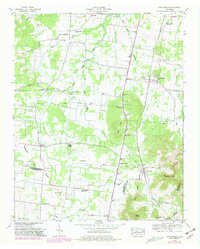
1949 Map of Fosterville
USGS Topo · Published 1980About this map
Fosterville and Christiana anchor this mid-century portrait of the Tennessee landscape where the Tennessee Valley Divide separates the drainage of the West Fork Stones River from the southern basins. The region’s development is defined by the Louisville and Nashville railroad and the Florida Short Route, which cut through the prominent terrain of the Nebo Knobs.
Find a feature on this map
47 named features on this map. Tap any name to fly to it.
Don’t see what you’re looking for? This feature index may not catch every label — zoom into the map to look around manually.
Map Details
Editions of this 1949 Fosterville Map
2 editions found
Other maps of this area

1916 · Murfreesboro
USGS Topo · 1:62,500

1936 · Webbs Jungle
USGS Topo · 1:24,000

1936 · Rover
USGS Topo · 1:24,000

1936 · Deason
USGS Topo · 1:24,000

1936 · Wartrace
USGS Topo · 1:24,000

1936 · Unionville
USGS Topo · 1:24,000

1936 · Fosterville
USGS Topo · 1:24,000

1942 · Lebanon
USGS Topo · 1:100,000

1944 · Shelbyville
USGS Topo · 1:100,000
1947 · Unionville
USGS Topo · 1:24,000