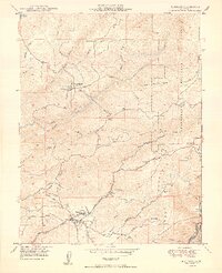
1949 Map of Murphys
USGS Topo · Published 1949About this map
Gold-country mining and hydraulic infrastructure dominate this post-war survey of Calaveras County. The settlement of Murphys serves as a southern hub, situated near the Bret Harte Sanatorium and the geological landmark Mercer Cave. The map traces an intricate network of water management essential to the region's industry, including the Utica Ditch, a Penstock, and the Utica Powerhouse along Angels Creek.
Find a feature on this map
46 named features on this map. Tap any name to fly to it.
Don’t see what you’re looking for? This feature index may not catch every label — zoom into the map to look around manually.
Map Details
Editions of this 1949 Murphys Map
2 editions found
Other maps of this area

1889 · Jackson
USGS Topo · 1:125,000

1891 · Big Trees
USGS Topo · 1:125,000

1892 · Jackson
USGS Topo · 1:125,000

1894 · Big Trees
USGS Topo · 1:125,000

1897 · Jackson
USGS Topo · 1:125,000

1897 · Big Trees
USGS Topo · 1:125,000

1901 · Big Trees
USGS Topo · 1:125,000

1902 · Jackson
USGS Topo · 1:125,000

1945 · San Andreas
USGS Topo · 1:62,500

1947 · San Andreas
USGS Topo · 1:62,500