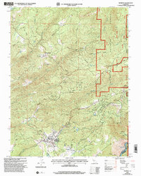
2001 Map of Murphys
USGS Topo · Published 2004About this map
The Sierra Nevada foothills of Calaveras County are depicted here in detail, centered on the community of Murphys. This area, deeply tied to California's mining and hydraulic power history, shows a landscape carved by Angels Creek, San Antonio Creek, and San Domingo Creek. The legacy of the Gold Rush era remains visible through numerous labels for Prospect sites and established operations like the Sheep Ranch Mine and Red Top Mine.
Find a feature on this map
53 named features on this map. Tap any name to fly to it.
Don’t see what you’re looking for? This feature index may not catch every label — zoom into the map to look around manually.
Map Details
Editions of this 2001 Murphys Map
This is the sole edition of this map. No revisions or reprints were ever made.
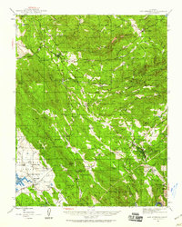
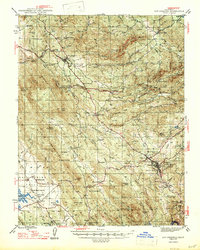
Other maps of this area

1889 · Jackson
USGS Topo · 1:125,000

1891 · Big Trees
USGS Topo · 1:125,000

1892 · Jackson
USGS Topo · 1:125,000

1894 · Big Trees
USGS Topo · 1:125,000

1897 · Jackson
USGS Topo · 1:125,000

1897 · Big Trees
USGS Topo · 1:125,000

1901 · Big Trees
USGS Topo · 1:125,000

1902 · Jackson
USGS Topo · 1:125,000
1945 · San Andreas
USGS Topo · 1:62,500
1947 · San Andreas
USGS Topo · 1:62,500