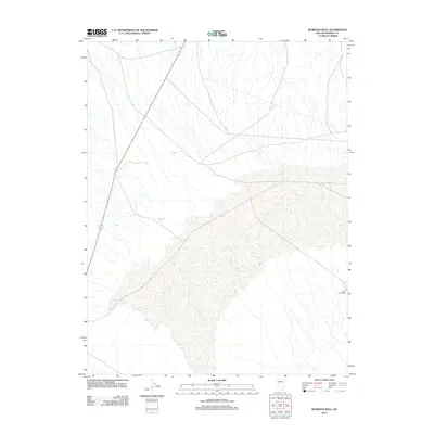
2011 Map of Murphys Well
USGS Topo · Published 2011About this map
Murphys Well serves as a primary reference point in this arid stretch of Mineral County, where water sources were historically vital for transit and survival. The landscape is defined by a complex network of ephemeral drainages that converge upon a large, central sandy area, possibly a playa or dry lake bed, which dominates the lower half of the quadrangle. Aside from the established road corridor, the terrain remains largely undeveloped, retaining the character of the Great Basin wilderness as it existed in 2011. Evidence of early resource management can be found at Mud Windmill, a lonely landmark in the eastern reaches of the map that points to the area's history of ranching and livestock grazing.
Find a feature on this map
2 named features on this map. Tap any name to fly to it.
Don’t see what you’re looking for? This feature index may not catch every label — zoom into the map to look around manually.
Map Details
Editions of this 2011 Murphys Well Map
This is the sole edition of this map. No revisions or reprints were ever made.
Other maps of this area

1908 · Carson Sink
USGS Topo · 1:250,000

1909 · Hawthorne
USGS Topo · 1:250,000

1910 · Carson Sink
USGS Topo · 1:250,000

1911 · Hawthorne
USGS Topo · 1:250,000

1915 · Hawthorne
USGS Topo · 1:250,000

1948 · Walker Lake
USGS Topo · 1:250,000

1957 · Walker Lake
USGS Topo · 1:250,000

1957 · Reno
USGS Topo · 1:250,000

1959 · Reno
USGS Topo · 1:250,000

1960 · Reno
USGS Topo · 1:250,000