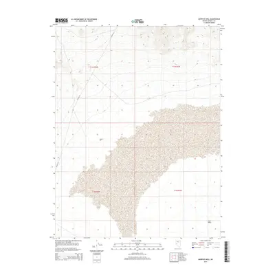
2014 Map of Murphys Well
USGS Topo · Published 2014About this map
Murphys Well provides a singular point of interest in this expansive desert landscape of Mineral County, Nevada. Located within the northern reaches of Gabbs Valley, this site represents the sparse but vital water infrastructure necessary for movement through the Great Basin. The terrain is defined by the high-elevation basin floor and the surrounding mountain slopes, where the Poleline Rd serves as the primary corridor for transit. This 2014 survey by the U.S. Geological Survey details the public land survey system grid across townships t13n r32e, t13n r33e, t12n r32e, and t12n r33e, illustrating the geometric subdivision of this arid terrain. The map captures a moment in the modern era of the valley, documenting the persistent utility of remote wells and utility-access roads in a landscape otherwise dominated by natural topography.
Find a feature on this map
7 named features on this map. Tap any name to fly to it.
Don’t see what you’re looking for? This feature index may not catch every label — zoom into the map to look around manually.
Map Details
Editions of this 2014 Murphys Well Map
This is the sole edition of this map. No revisions or reprints were ever made.
Other maps of this area

1908 · Carson Sink
USGS Topo · 1:250,000

1909 · Hawthorne
USGS Topo · 1:250,000

1910 · Carson Sink
USGS Topo · 1:250,000

1911 · Hawthorne
USGS Topo · 1:250,000

1915 · Hawthorne
USGS Topo · 1:250,000

1948 · Walker Lake
USGS Topo · 1:250,000

1957 · Walker Lake
USGS Topo · 1:250,000

1957 · Reno
USGS Topo · 1:250,000

1959 · Reno
USGS Topo · 1:250,000

1960 · Reno
USGS Topo · 1:250,000