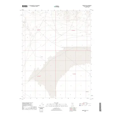
2018 Map of Murphys Well
USGS Topo · Published 2018About this map
Murphys Well serves as a central landmark in this arid portion of Mineral County, where the landscape is defined by the transition between the Rawhide Hills to the northwest and the expansive Gabbs Valley to the south. This 2018 survey documents a remote desert environment characterized by township and range divisions, including t13n r32e and t13n r33e. The topography is largely defined by the drainage patterns and desert flats typical of the Great Basin. While few permanent structures are noted, the map provides critical detail for navigating the basin floor and the surrounding hills, illustrating the sparse network of desert roads and tracks that connect these isolated watering points and geographical features within the larger Nevada wilderness.
Find a feature on this map
7 named features on this map. Tap any name to fly to it.
Don’t see what you’re looking for? This feature index may not catch every label — zoom into the map to look around manually.
Map Details
Editions of this 2018 Murphys Well Map
This is the sole edition of this map. No revisions or reprints were ever made.
Other maps of this area

1908 · Carson Sink
USGS Topo · 1:250,000

1909 · Hawthorne
USGS Topo · 1:250,000

1910 · Carson Sink
USGS Topo · 1:250,000

1911 · Hawthorne
USGS Topo · 1:250,000

1915 · Hawthorne
USGS Topo · 1:250,000

1948 · Walker Lake
USGS Topo · 1:250,000

1957 · Walker Lake
USGS Topo · 1:250,000

1957 · Reno
USGS Topo · 1:250,000

1959 · Reno
USGS Topo · 1:250,000

1960 · Reno
USGS Topo · 1:250,000