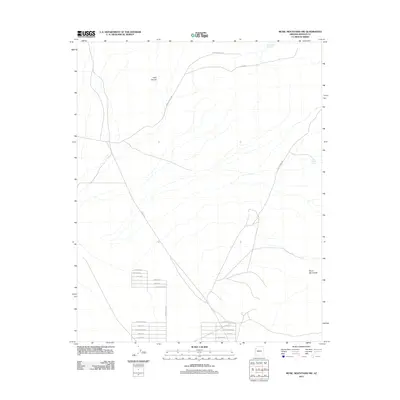
2011 Map of Music Mountains NW
USGS Topo · Published 2011About this map
Hells Canyon and the Music Mountains dominate this high-desert region of Mohave County during the early 21st century. The map reveals an emerging residential grid in the southern portion of the quadrangle, where a series of streets including El Caminito Blvd, Calle Rosa Blvd, and Rancho Vista Rd have been established across the arid landscape. This planned development contrasts sharply with the more remote northern reaches, which are defined by large-scale ranching and land management routes such as Tenney Ranch Rd and B L M Rd. Essential water sources for the area, such as Lost Creek Reservoir and the isolated Fred Jackson Spring, are clearly marked, illustrating the critical infrastructure required for settlement in this part of Arizona. The path of Co Hwy 149 serves as a primary artery connecting these new subdivisions to the broader region.
Find a feature on this map
20 named features on this map. Tap any name to fly to it.
Don’t see what you’re looking for? This feature index may not catch every label — zoom into the map to look around manually.
Map Details
Editions of this 2011 Music Mountains NW Map
This is the sole edition of this map. No revisions or reprints were ever made.
Other maps of this area

1886 · Diamond Creek
USGS Topo · 1:250,000

1886 · Camp Mohave
USGS Topo · 1:250,000

1892 · Diamond Creek
USGS Topo · 1:250,000

1892 · Camp Mohave
USGS Topo · 1:250,000

1942 · Camp Mohave
USGS Topo · 1:250,000

1947 · Kingman
USGS Topo · 1:250,000

1948 · Kingman
USGS Topo · 1:250,000

1948 · Williams
USGS Topo · 1:250,000

1954 · Kingman
USGS Topo · 1:250,000

1954 · Williams
USGS Topo · 1:250,000