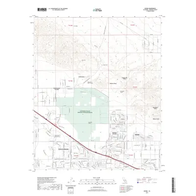
2018 Map of Myoma
USGS Topo · Published 2018About this map
The Coachella Valley National Wildlife Refuge dominates the center of this 2018 survey, preserving a critical desert ecosystem amid the rapid residential expansion of the Coachella Valley. The map documents the urban interface where the developed streets of Palm Desert, Desert Palms, and northwestern Indio meet the arid landscape of the Indio Hills. Notable for its unique grove locations, the map identifies several oases such as Willis Palms, Pushawalla Palms, and Macomber Palms, which stand in stark contrast to the surrounding desert terrain.
Find a feature on this map
43 named features on this map. Tap any name to fly to it.
Don’t see what you’re looking for? This feature index may not catch every label — zoom into the map to look around manually.
Map Details
Editions of this 2018 Myoma Map
This is the sole edition of this map. No revisions or reprints were ever made.
Other maps of this area

1904 · Indio
USGS Topo · 1:125,000

1941 · Toro Peak
USGS Topo · 1:62,500

1941 · Coachella
USGS Topo · 1:62,500

1941 · Edom
USGS Topo · 1:62,500

1943 · Coachella
USGS Topo · 1:62,500

1944 · Toro peak
USGS Topo · 1:62,500

1944 · Edom
USGS Topo · 1:62,500

1944 · Pinyon Well
USGS Topo · 1:62,500

1947 · Santa Ana
USGS Topo · 1:250,000

1949 · Santa Ana
USGS Topo · 1:250,000