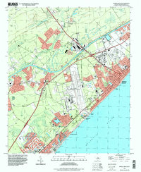
2024 Map of Myrtle Beach
USGS Topo · Published 2024About this map
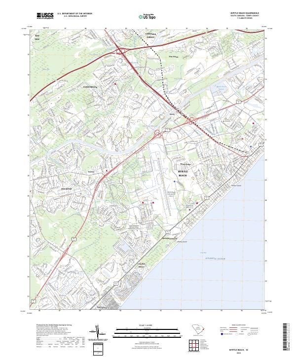
The Intracoastal Waterway carves through the heart of this coastal landscape, separating the mainland settlements of Socastee and Forestbrook from the bustling shores of Myrtle Beach. This contemporary look at the Grand Strand reveals a complex network of residential developments and commercial hubs flanking the Atlantic Ocean. Significant infrastructure like the Myrtle Beach International Airport and the Horry Georgetown Technical College - Grand Strand Campus anchor the central corridor, while residential pockets like Stalvey and Long Bay Estates illustrate the dense settlement patterns of the modern era.
Find a feature on this map
399 named features on this map. Tap any name to fly to it.
Don’t see what you’re looking for? This feature index may not catch every label — zoom into the map to look around manually.
Map Details
Editions of this 2024 Myrtle Beach Map
This is the sole edition of this map. No revisions or reprints were ever made.
Historical Maps of Konig Through Time
7 maps found