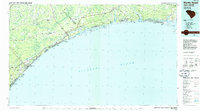
1986 Map of Myrtle Beach
USGS Topo · Published 1986About this map
The Grand Strand of South Carolina and the southern Brunswick County coast of North Carolina meet in this mid-1980s survey, illustrating a region defined by its shifting relationship between tourism and military infrastructure. Myrtle Beach Air Force Base stands as a massive anchor on the coast, adjacent to the preserved shoreline of Myrtle Beach State Park. The map documents the dense string of coastal communities including North Myrtle Beach, Atlantic Beach, and Surfside Beach, all connected by the inland path of the Intracoastal Waterway and the Seaboard System railroad tracks.
Find a feature on this map
95 named features on this map. Tap any name to fly to it.
Don’t see what you’re looking for? This feature index may not catch every label — zoom into the map to look around manually.
Map Details
Editions of this 1986 Myrtle Beach Map
This is the sole edition of this map. No revisions or reprints were ever made.
Other maps of this area

1937 · Myrtle Beach
USGS Topo · 1:48,000

1937 · Nixonville
USGS Topo · 1:48,000

1940 · Myrtle Beach
USGS Topo · 1:62,500

1942 · Nixonville
USGS Topo · 1:62,500

1942 · Wilmington
USGS Topo · 1:62,500

1942 · Cape Fear
USGS Topo · 1:24,000

1942 · Magnolia Beach
USGS Topo · 1:24,000

1943 · Little River
USGS Topo · 1:31,680

1943 · Pireway
USGS Topo · 1:31,680

1943 · Calabash
USGS Topo · 1:31,680