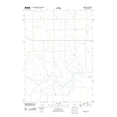
2011 Map of Naper NW
USGS Topo · Published 2011About this map
The Keya Paha River winds through the southern portion of this landscape, fed by a network of drainage systems including Meglin Creek, Morse Creek, and Naper Creek. The terrain is defined by its agricultural and hydrological management, evidenced by features such as Hamling Dam and Cline Dam. For genealogists and local historians, several burial sites are preserved across the quadrangle, including Naper Cemetery and German Cemetery in the northeast, and Oakdale Cemetery situated further south. Named for the pioneering African American filmmaker and author who homesteaded nearby, Oscar Micheaux Creek flows through the northern section, marking a unique cultural connection to the region's homesteading history. The map also captures the topography of Silver Gulch and the course of Big Creek as they converge toward the river valley.
Find a feature on this map
15 named features on this map. Tap any name to fly to it.
Don’t see what you’re looking for? This feature index may not catch every label — zoom into the map to look around manually.
Map Details
Editions of this 2011 Naper NW Map
This is the sole edition of this map. No revisions or reprints were ever made.
Other maps of this area

1950 · Mariaville
USGS Topo · 1:24,000

1951 · Naper
USGS Topo · 1:24,000

1951 · Dustin
USGS Topo · 1:24,000

1951 · Naper SW
USGS Topo · 1:24,000

1955 · Mitchell
USGS Topo · 1:250,000

1955 · O'Neill
USGS Topo · 1:250,000

1959 · O'Neill
USGS Topo · 1:250,000

1959 · Mitchell
USGS Topo · 1:250,000

1964 · Gregory SE
USGS Topo · 1:24,000

1964 · St. Charles
USGS Topo · 1:24,000