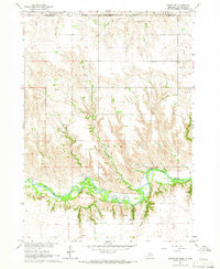
1964 Map of Naper NW
USGS Topo · Published 1966About this map
The Keya Paha River winds through the southern portion of this landscape, its path defining a lush valley floor set against the broader Basin. Along the northern edge, the boundary of the Rosebud Indian South Dakota Reservation marks the transition between Nebraska and South Dakota, reflecting the complex administrative history of the Great Plains. The topography is etched by numerous drainages including Morse Creek, Wright Creek, and Hay Creek, which have carved deep draws into the prairie. Genealogists and local historians will find significant value in the distribution of rural burial sites, specifically the Naper Cem, German Cem, and Oakdale Cem, which serve as quiet markers of the early families who settled the Spring Valley region. The presence of a Gravel Pit and various fence lines suggest the ongoing agricultural and infrastructural development of the area in the mid-1960s.
Find a feature on this map
18 named features on this map. Tap any name to fly to it.
Don’t see what you’re looking for? This feature index may not catch every label — zoom into the map to look around manually.
Map Details
Editions of this 1964 Naper NW Map
This is the sole edition of this map. No revisions or reprints were ever made.
Other maps of this area

1950 · Mariaville
USGS Topo · 1:24,000

1951 · Naper
USGS Topo · 1:24,000

1951 · Dustin
USGS Topo · 1:24,000

1951 · Naper SW
USGS Topo · 1:24,000

1955 · Mitchell
USGS Topo · 1:250,000

1955 · O'Neill
USGS Topo · 1:250,000

1959 · O'Neill
USGS Topo · 1:250,000

1959 · Mitchell
USGS Topo · 1:250,000

1964 · Gregory SE
USGS Topo · 1:24,000

1964 · St. Charles
USGS Topo · 1:24,000